Kirnberg an der Mank geodata
Kirnberg an der Mank (Lower Austria) is a seat of a third-order administrative division; located in Austria in Europe/Vienna (GMT+2) time zone. With population of 551 people, there are 2316 cities with bigger population in this country. Compared to other cities in Austria, 70.9% of cities are located further ↓South; 60.9% of cities are located further ←West and 69.8% of cities have higher elevation than Kirnberg an der Mank. Note1
Administrative division(s):
- Level 1: Lower Austria
- Level 2: Politischer Bezirk Melk
- Level 3: Kirnberg an der Mank


Kirnberg an der Mank GPS coordinates[2]
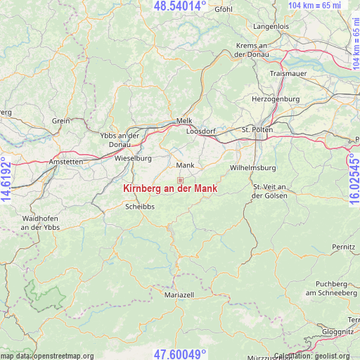
48° 4' 20.856" North, 15° 19' 20.352" East
| Map corner | latitude | longitude |
|---|---|---|
| Upper-left | 48.54014°, | 14.6192° |
| Center: | 48.07246°, | 15.32232° |
| Lower-right: | 47.60049°, | 16.02545° |
| Map W x H: | 104.5×104.5 km | = 64.9×64.9mi |
| max Lat: | 48.98333° ⇑29.1% North |
| Kirnberg an der Mank: | 48.07246° |
| min Lat: | ⇓70.9% South 46.48841° |
| min Long | Kirnberg an der | max Long |
| 9.57802° | 15.32232° | 17.1° |
| W 60.9%⇐ | ⇒39.1% E |
Elevation
Elevation of Kirnberg an der Mank is 329 m = 1079 ft, and this is 176.5 m = 579 ft below average elevation for this country.
| Max E: |
2140 m = 7021 ft | 69.8% |
| Avg. | 505.5 m = 1658 ft | |
| Kirnberg an der Mank | 329 m = 1079 ft | |
Min E: |
118 m = 387 ft | 30.2% |
See also: Austria elevation on elevation.city.
Geographical zone
Kirnberg an der Mank is located in North temperate zone (between Tropic of Cancer and the Arctic Circle). Distance of this North polar circle is 2056 km =1277.5 mi to North.| Distance of | km | miles | from Kirnberg an der Mank |
|---|---|---|---|
| North Pole | 4661.9 | 2896.8 | to North |
| Arctic Circle | 2056 | 1277.5 | to North |
| Tropic Cancer | 2739.2 | 1702.1 | to South |
| Equator | 5345.2 | 3321.4 | to South |


Nearby cities:
15 places around Kirnberg an der Mank: (largest is in red/bold)
• Bischofstetten
12.2 km =7.6 mi,  63°
63°
• Dorf Au
10.5 km =6.5 mi,  93°
93°
• Frankenfels
10 km =6.2 mi,  178°
178°
• Gries bei Oberndorf
8.2 km =5.1 mi,  264°
264°
• Hürm
11.5 km =7.1 mi,  35°
35°
• Kilb
7.1 km =4.4 mi, 63°
• Kirchberg an der Pielach
9.4 km =5.8 mi,  122°
122°
• Loich
10.4 km =6.5 mi,  145°
145°
• Mank
4.4 km =2.7 mi,  16°
16°
• Oberndorf an der Melk
7.3 km =4.5 mi, 262°
• Rabenstein an der Pielach
10.8 km =6.7 mi, 94°
• Ruprechtshofen
7.9 km =4.9 mi,  334°
334°
• Sankt Georgen an der Leys
8.4 km =5.2 mi,  237°
237°
• Sankt Leonhard am Forst
8.3 km =5.2 mi,  340°
340°
• Soisgegend
13.4 km =8.3 mi,  131°
131°
Sources, notices
• [Note1] Compared only with cities in Austria existing in our database
• [Src1] Map data: © OpenStreetMap contributors (CC-BY-SA)
• [Src2] Other city data from geonames.org with taken over terms of usage.
• [Src3] Geographical zone / Annual Mean Temperature by Robert A. Rohde @ Wikipedia
