Schwarzenbach geodata
Schwarzenbach (Lower Austria) is a seat of a third-order administrative division; located in Austria in Europe/Vienna (GMT+2) time zone. With population of 941 people, there are 1366 cities with bigger population in this country. Compared to other cities in Austria, 51.6% of cities are located further ↓South; 90% of cities are located further ←West and 61.2% of cities have higher elevation than Schwarzenbach. Note1
Administrative division(s):
- Level 1: Lower Austria
- Level 2: Politischer Bezirk Wiener Neustadt
- Level 3: Schwarzenbach


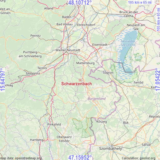
Schwarzenbach GPS coordinates[2]
47° 38' 7.692" North, 16° 21' 3.924" East
| Map corner | latitude | longitude |
|---|---|---|
| Upper-left | 48.10712°, | 15.64797° |
| Center: | 47.63547°, | 16.35109° |
| Lower-right: | 47.15952°, | 17.05422° |
| Map W x H: | 105.4×105.4 km | = 65.5×65.5mi |
| max Lat: | 48.98333° ⇑48.4% North |
| Schwarzenbach: | 47.63547° |
| min Lat: | ⇓51.6% South 46.48841° |
| min Long | Schwarzenbach | max Long |
| 9.57802° | 16.35109° | 17.1° |
| W 90%⇐ | ⇒10% E |
Elevation
Elevation of Schwarzenbach is 376 m = 1234 ft, and this is 129.5 m = 425 ft below average elevation for this country.
| Max E: |
2140 m = 7021 ft | 61.2% |
| Avg. | 505.5 m = 1658 ft | |
| Schwarzenbach | 376 m = 1234 ft | |
Min E: |
118 m = 387 ft | 38.8% |
See also: Austria elevation on elevation.city.
Geographical zone
Schwarzenbach is located in North temperate zone (between Tropic of Cancer and the Arctic Circle). Distance of this North polar circle is 2104.6 km =1307.7 mi to North.| Distance of | km | miles | from Schwarzenbach |
|---|---|---|---|
| North Pole | 4710.5 | 2927 | to North |
| Arctic Circle | 2104.6 | 1307.7 | to North |
| Tropic Cancer | 2690.6 | 1671.9 | to South |
| Equator | 5296.6 | 3291.2 | to South |


Nearby cities:
15 places around Schwarzenbach: (largest is in red/bold)
• Forchtenstein
8.5 km =5.3 mi,  357°
357°
• Hochwolkersdorf
6 km =3.7 mi,  298°
298°
• Hollenthon
8.5 km =5.3 mi,  232°
232°
• Kobersdorf
5.4 km =3.4 mi,  145°
145°
• Lackenbach
9.9 km =6.2 mi,  120°
120°
• Markt Sankt Martin
9.9 km =6.2 mi, 145°
• Marz
10.3 km =6.4 mi,  28°
28°
• Oberpetersdorf
2.9 km =1.8 mi,  139°
139°
• Ritzing
11.1 km =6.9 mi,  102°
102°
• Rohrbach bei Mattersburg
9.8 km =6.1 mi,  37°
37°
• Schlatten
7.7 km =4.8 mi,  282°
282°
• Sieggraben
2.8 km =1.7 mi,  50°
50°
• Tschurndorf
5.1 km =3.2 mi,  127°
127°
• Weppersdorf
8.4 km =5.2 mi, 137°
• Wiesmath
5.5 km =3.4 mi,  247°
247°
Sources, notices
• [Note1] Compared only with cities in Austria existing in our database
• [Src1] Map data: © OpenStreetMap contributors (CC-BY-SA)
• [Src2] Other city data from geonames.org with taken over terms of usage.
• [Src3] Geographical zone / Annual Mean Temperature by Robert A. Rohde @ Wikipedia
