Sieggraben geodata
Sieggraben (Burgenland) is a seat of a third-order administrative division; located in Austria in Europe/Vienna (GMT+2) time zone. With population of 1,248 people, there are 1007 cities with bigger population in this country. Compared to other cities in Austria, 52.1% of cities are located further ↓South; 90.6% of cities are located further ←West and 52.1% of cities have lower elevation than Sieggraben. Note1
Administrative division(s):
- Level 1: Burgenland
- Level 2: Politischer Bezirk Mattersburg
- Level 3: Sieggraben


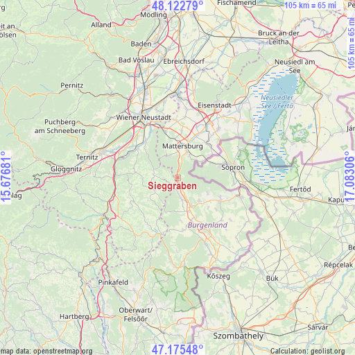
Sieggraben GPS coordinates[2]
47° 39' 4.608" North, 16° 22' 47.748" East
| Map corner | latitude | longitude |
|---|---|---|
| Upper-left | 48.12279°, | 15.67681° |
| Center: | 47.65128°, | 16.37993° |
| Lower-right: | 47.17548°, | 17.08306° |
| Map W x H: | 105.3×105.3 km | = 65.4×65.4mi |
| max Lat: | 48.98333° ⇑47.9% North |
| Sieggraben: | 47.65128° |
| min Lat: | ⇓52.1% South 46.48841° |
| min Long | Sieggraben | max Long |
| 9.57802° | 16.37993° | 17.1° |
| W 90.6%⇐ | ⇒9.4% E |
Elevation
Elevation of Sieggraben is 466 m = 1529 ft, and this is 39.5 m = 130 ft below average elevation for this country.
| Max E: |
2140 m = 7021 ft | 47.9% |
| Avg. | 505.5 m = 1658 ft | |
| Sieggraben | 466 m = 1529 ft | |
Min E: |
118 m = 387 ft | 52.1% |
See also: Austria elevation on elevation.city.
Geographical zone
Sieggraben is located in North temperate zone (between Tropic of Cancer and the Arctic Circle). Distance of this North polar circle is 2102.8 km =1306.6 mi to North.| Distance of | km | miles | from Sieggraben |
|---|---|---|---|
| North Pole | 4708.7 | 2925.8 | to North |
| Arctic Circle | 2102.8 | 1306.6 | to North |
| Tropic Cancer | 2692.4 | 1673 | to South |
| Equator | 5298.3 | 3292.2 | to South |


Nearby cities:
15 places around Sieggraben: (largest is in red/bold)
• Forchtenstein
7.2 km =4.5 mi,  338°
338°
• Hochwolkersdorf
7.5 km =4.7 mi,  278°
278°
• Kobersdorf
6.2 km =3.9 mi,  171°
171°
• Lackenbach
9.3 km =5.8 mi,  136°
136°
• Loipersbach im Burgenland
9 km =5.6 mi,  55°
55°
• Marz
7.8 km =4.8 mi,  20°
20°
• Mattersburg
9.2 km =5.7 mi,  9°
9°
• Oberpetersdorf
4 km =2.5 mi,  183°
183°
• Ritzing
9.6 km =6 mi,  116°
116°
• Rohrbach bei Mattersburg
7.1 km =4.4 mi,  32°
32°
• Schlatten
9.7 km =6 mi,  269°
269°
• Schwarzenbach
2.8 km =1.7 mi,  230°
230°
• Tschurndorf
5.2 km =3.2 mi,  158°
158°
• Weppersdorf
8.7 km =5.4 mi, 156°
• Wiesmath
8.2 km =5.1 mi,  242°
242°
Sources, notices
• [Note1] Compared only with cities in Austria existing in our database
• [Src1] Map data: © OpenStreetMap contributors (CC-BY-SA)
• [Src2] Other city data from geonames.org with taken over terms of usage.
• [Src3] Geographical zone / Annual Mean Temperature by Robert A. Rohde @ Wikipedia
