Bad Eisenkappel geodata
Bad Eisenkappel (Carinthia) is a populated place; located in Austria in Europe/Vienna (GMT+2) time zone. With population of 882 people, there are 1464 cities with bigger population in this country. Compared to other cities in Austria, 100% of cities are located further ↑North; 51.7% of cities are located further →East and 65.2% of cities have lower elevation than Bad Eisenkappel. Note1
Administrative division(s):
- Level 1: Carinthia
- Level 2: Politischer Bezirk Völkermarkt
- Level 3: Eisenkappel-Vellach


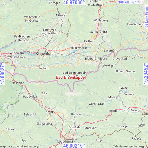
Bad Eisenkappel GPS coordinates[2]
46° 29' 18.276" North, 14° 35' 29.004" East
| Map corner | latitude | longitude |
|---|---|---|
| Upper-left | 46.97036°, | 13.88827° |
| Center: | 46.48841°, | 14.59139° |
| Lower-right: | 46.00215°, | 15.29452° |
| Map W x H: | 107.7×107.7 km | = 66.9×66.9mi |
| max Lat: | 48.98333° ⇑100% North |
| Bad Eisenkappel: | 46.48841° |
| min Lat: | ⇓0% South 46.48841° |
| min Long | Bad Eisenkappel | max Long |
| 9.57802° | 14.59139° | 17.1° |
| W 48.3%⇐ | ⇒51.7% E |
Elevation
Elevation of Bad Eisenkappel is 554 m = 1818 ft, and this is 48.5 m = 159 ft above average elevation for this country.
| Max E: |
2140 m = 7021 ft | 34.8% |
| Bad Eisenkappel | 554 m 1818 ft | |
| Avg. | 505.5 m = 1658 ft | |
Min E: |
118 m = 387 ft | 65.2% |
See also: Austria elevation on elevation.city.
Geographical zone
Bad Eisenkappel is located in North temperate zone (between Tropic of Cancer and the Arctic Circle). Distance of this North polar circle is 2232.1 km =1387 mi to North.| Distance of | km | miles | from Bad Eisenkappel |
|---|---|---|---|
| North Pole | 4838 | 3006.2 | to North |
| Arctic Circle | 2232.1 | 1387 | to North |
| Tropic Cancer | 2563.1 | 1592.6 | to South |
| Equator | 5169 | 3211.9 | to South |


Nearby cities:
15 places around Bad Eisenkappel: (largest is in red/bold)
• Bleiburg/Pliberk
19.5 km =12.1 mi,  54°
54°
• Eberndorf
12.1 km =7.5 mi,  19°
19°
• Ebersdorf
18.1 km =11.2 mi, 54°
• Feistritz ob Bleiburg
15.1 km =9.4 mi,  62°
62°
• Gallizien
8.9 km =5.5 mi,  320°
320°
• Globasnitz
11.4 km =7.1 mi, 48°
• Grafenstein
16.9 km =10.5 mi,  325°
325°
• Gösselsdorf
10 km =6.2 mi, 19°
• Kühnsdorf
15.2 km =9.4 mi,  13°
13°
• Mittlern
16.3 km =10.1 mi,  37°
37°
• Sankt Margareten im Rosental
14.2 km =8.8 mi,  295°
295°
• Sankt Michael ob Bleiburg
15.4 km =9.6 mi, 49°
• Sittersdorf
6.3 km =3.9 mi, 10°
• Tainach
16.7 km =10.4 mi,  344°
344°
• Wasserhofen
14.4 km =8.9 mi, 7°
Sources, notices
• [Note1] Compared only with cities in Austria existing in our database
• [Src1] Map data: © OpenStreetMap contributors (CC-BY-SA)
• [Src2] Other city data from geonames.org with taken over terms of usage.
• [Src3] Geographical zone / Annual Mean Temperature by Robert A. Rohde @ Wikipedia
