Neutal geodata
Neutal (Burgenland) is a seat of a third-order administrative division; located in Austria in Europe/Vienna (GMT+2) time zone. With population of 1,094 people, there are 1167 cities with bigger population in this country. Compared to other cities in Austria, 51.7% of cities are located further ↑North; 92.5% of cities are located further ←West and 80.2% of cities have higher elevation than Neutal. Note1
Administrative division(s):
- Level 1: Burgenland
- Level 2: Politischer Bezirk Oberpullendorf
- Level 3: Neutal


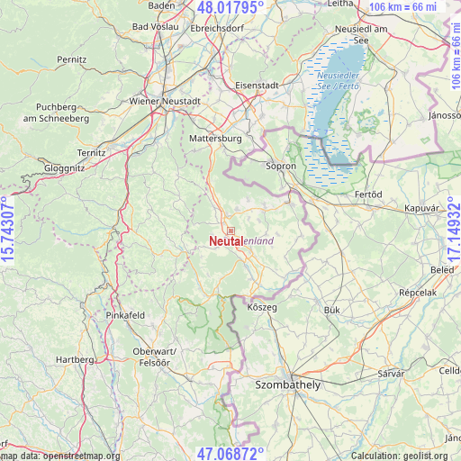
Neutal GPS coordinates[2]
47° 32' 43.728" North, 16° 26' 46.284" East
| Map corner | latitude | longitude |
|---|---|---|
| Upper-left | 48.01795°, | 15.74307° |
| Center: | 47.54548°, | 16.44619° |
| Lower-right: | 47.06872°, | 17.14932° |
| Map W x H: | 105.5×105.5 km | = 65.6×65.6mi |
| max Lat: | 48.98333° ⇑51.7% North |
| Neutal: | 47.54548° |
| min Lat: | ⇓48.3% South 46.48841° |
| min Long | Neutal | max Long |
| 9.57802° | 16.44619° | 17.1° |
| W 92.5%⇐ | ⇒7.5% E |
Elevation
Elevation of Neutal is 274 m = 899 ft, and this is 231.5 m = 760 ft below average elevation for this country.
| Max E: |
2140 m = 7021 ft | 80.2% |
| Avg. | 505.5 m = 1658 ft | |
| Neutal | 274 m = 899 ft | |
Min E: |
118 m = 387 ft | 19.8% |
See also: Austria elevation on elevation.city.
Geographical zone
Neutal is located in North temperate zone (between Tropic of Cancer and the Arctic Circle). Distance of this North polar circle is 2114.6 km =1314 mi to North.| Distance of | km | miles | from Neutal |
|---|---|---|---|
| North Pole | 4720.5 | 2933.2 | to North |
| Arctic Circle | 2114.6 | 1314 | to North |
| Tropic Cancer | 2680.6 | 1665.6 | to South |
| Equator | 5286.6 | 3284.9 | to South |


Nearby cities:
15 places around Neutal: (largest is in red/bold)
• Drassmarkt
4.7 km =2.9 mi,  227°
227°
• Dörfl im Burgenland
7.5 km =4.7 mi,  158°
158°
• Grosswarasdorf
8.1 km =5 mi,  95°
95°
• Kaisersdorf
4.2 km =2.6 mi,  257°
257°
• Kobersdorf
6.9 km =4.3 mi,  323°
323°
• Lackenbach
5.2 km =3.2 mi,  16°
16°
• Lackendorf
6.6 km =4.1 mi,  41°
41°
• Markt Sankt Martin
2.4 km =1.5 mi, 319°
• Oberpullendorf
6.4 km =4 mi,  136°
136°
• Raiding
6.7 km =4.2 mi,  70°
70°
• Stoob
3 km =1.9 mi,  128°
128°
• Tschurndorf
7.6 km =4.7 mi,  336°
336°
• Unterfrauenhaid
4.9 km =3 mi,  54°
54°
• Weingraben
7.1 km =4.4 mi,  240°
240°
• Weppersdorf
4.1 km =2.5 mi, 338°
Sources, notices
• [Note1] Compared only with cities in Austria existing in our database
• [Src1] Map data: © OpenStreetMap contributors (CC-BY-SA)
• [Src2] Other city data from geonames.org with taken over terms of usage.
• [Src3] Geographical zone / Annual Mean Temperature by Robert A. Rohde @ Wikipedia
