Ritzing geodata
Ritzing (Burgenland) is a seat of a third-order administrative division; located in Austria in Europe/Vienna (GMT+2) time zone. With population of 902 people, there are 1424 cities with bigger population in this country. Compared to other cities in Austria, 50.9% of cities are located further ↓South; 93.8% of cities are located further ←West and 71.7% of cities have higher elevation than Ritzing. Note1
Administrative division(s):
- Level 1: Burgenland
- Level 2: Politischer Bezirk Oberpullendorf
- Level 3: Ritzing


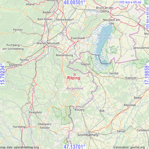
Ritzing GPS coordinates[2]
47° 36' 47.376" North, 16° 29' 43.656" East
| Map corner | latitude | longitude |
|---|---|---|
| Upper-left | 48.08501°, | 15.79234° |
| Center: | 47.61316°, | 16.49546° |
| Lower-right: | 47.13701°, | 17.19859° |
| Map W x H: | 105.4×105.4 km | = 65.5×65.5mi |
| max Lat: | 48.98333° ⇑49.1% North |
| Ritzing: | 47.61316° |
| min Lat: | ⇓50.9% South 46.48841° |
| min Long | Ritzing | max Long |
| 9.57802° | 16.49546° | 17.1° |
| W 93.8%⇐ | ⇒6.2% E |
Elevation
Elevation of Ritzing is 320 m = 1050 ft, and this is 185.5 m = 609 ft below average elevation for this country.
| Max E: |
2140 m = 7021 ft | 71.7% |
| Avg. | 505.5 m = 1658 ft | |
| Ritzing | 320 m = 1050 ft | |
Min E: |
118 m = 387 ft | 28.3% |
See also: Austria elevation on elevation.city.
Geographical zone
Ritzing is located in North temperate zone (between Tropic of Cancer and the Arctic Circle). Distance of this North polar circle is 2107.1 km =1309.3 mi to North.| Distance of | km | miles | from Ritzing |
|---|---|---|---|
| North Pole | 4713 | 2928.5 | to North |
| Arctic Circle | 2107.1 | 1309.3 | to North |
| Tropic Cancer | 2688.2 | 1670.4 | to South |
| Equator | 5294.1 | 3289.6 | to South |


Nearby cities:
15 places around Ritzing: (largest is in red/bold)
• Grosswarasdorf
9.3 km =5.8 mi,  152°
152°
• Horitschon
4.8 km =3 mi,  126°
126°
• Kobersdorf
8 km =5 mi,  255°
255°
• Lackenbach
3.4 km =2.1 mi,  221°
221°
• Lackendorf
2.7 km =1.7 mi,  165°
165°
• Loipersbach im Burgenland
9.4 km =5.8 mi,  352°
352°
• Markt Sankt Martin
7.8 km =4.8 mi, 222°
• Neckenmarkt
4.1 km =2.5 mi,  111°
111°
• Neutal
8.4 km =5.2 mi,  206°
206°
• Oberpetersdorf
8.9 km =5.5 mi,  271°
271°
• Raiding
5.9 km =3.7 mi, 153°
• Stoob
9.5 km =5.9 mi,  188°
188°
• Tschurndorf
6.8 km =4.2 mi, 264°
• Unterfrauenhaid
4.7 km =2.9 mi,  176°
176°
• Weppersdorf
6.4 km =4 mi,  234°
234°
Sources, notices
• [Note1] Compared only with cities in Austria existing in our database
• [Src1] Map data: © OpenStreetMap contributors (CC-BY-SA)
• [Src2] Other city data from geonames.org with taken over terms of usage.
• [Src3] Geographical zone / Annual Mean Temperature by Robert A. Rohde @ Wikipedia
