Bramberg am Wildkogel geodata
Bramberg am Wildkogel (Salzburg) is a seat of a third-order administrative division; located in Austria in Europe/Vienna (GMT+2) time zone. With population of 2,096 people, there are 580 cities with bigger population in this country. Compared to other cities in Austria, 67.9% of cities are located further ↑North; 86.9% of cities are located further →East and 86.9% of cities have lower elevation than Bramberg am Wildkogel. Note1
Administrative division(s):
- Level 1: Salzburg
- Level 2: Politischer Bezirk Zell am See
- Level 3: Bramberg am Wildkogel


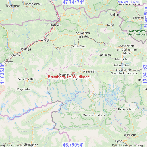
Bramberg am Wildkogel GPS coordinates[2]
47° 16' 11.244" North, 12° 20' 18.6" East
| Map corner | latitude | longitude |
|---|---|---|
| Upper-left | 47.74474°, | 11.63538° |
| Center: | 47.26979°, | 12.3385° |
| Lower-right: | 46.79054°, | 13.04163° |
| Map W x H: | 106.1×106.1 km | = 65.9×65.9mi |
| max Lat: | 48.98333° ⇑67.9% North |
| Bramberg am Wildkogel: | 47.26979° |
| min Lat: | ⇓32.1% South 46.48841° |
| min Long | Bramberg am Wil | max Long |
| 9.57802° | 12.3385° | 17.1° |
| W 13.1%⇐ | ⇒86.9% E |
Elevation
Elevation of Bramberg am Wildkogel is 826 m = 2710 ft, and this is 320.5 m = 1052 ft above average elevation for this country.
| Max E: |
2140 m = 7021 ft | 13.1% |
| Bramberg am Wildkogel | 826 m 2710 ft | |
| Avg. | 505.5 m = 1658 ft | |
Min E: |
118 m = 387 ft | 86.9% |
See also: Austria elevation on elevation.city.
Geographical zone
Bramberg am Wildkogel is located in North temperate zone (between Tropic of Cancer and the Arctic Circle). Distance of this North polar circle is 2145.3 km =1333 mi to North.| Distance of | km | miles | from Bramberg am Wildkogel |
|---|---|---|---|
| North Pole | 4751.2 | 2952.3 | to North |
| Arctic Circle | 2145.3 | 1333 | to North |
| Tropic Cancer | 2650 | 1646.6 | to South |
| Equator | 5255.9 | 3265.9 | to South |


Nearby cities:
15 places around Bramberg am Wildkogel: (largest is in red/bold)
• Aurach
17.2 km =10.7 mi,  22°
22°
• Burk
11.9 km =7.4 mi,  80°
80°
• Felben
11 km =6.8 mi, 82°
• Hollersbach im Pinzgau
6.4 km =4 mi, 83°
• Jochberg
13.6 km =8.5 mi,  26°
26°
• Kirchberg in Tirol
19.6 km =12.2 mi,  355°
355°
• Kitzbühel
20 km =12.4 mi,  11°
11°
• Krimml
13.6 km =8.5 mi,  244°
244°
• Mittersill
11 km =6.8 mi, 82°
• Neukirchen am Großvenediger
5.2 km =3.2 mi,  245°
245°
• Oberkrimml
14.3 km =8.9 mi, 245°
• Rosenthal
7 km =4.3 mi, 251°
• Stuhlfelden
14.4 km =8.9 mi, 82°
• Uttendorf
17.3 km =10.7 mi,  85°
85°
• Wald im Pinzgau
8.2 km =5.1 mi, 254°
In other languages:
- In Russian: Брамер-ам-Вильдкогель, Брамберг-ам-Вильдкогель
- In Chinese: 维尔德科格尔山麓布兰贝格
Sources, notices
• [Note1] Compared only with cities in Austria existing in our database
• [Src1] Map data: © OpenStreetMap contributors (CC-BY-SA)
• [Src2] Other city data from geonames.org with taken over terms of usage.
• [Src3] Geographical zone / Annual Mean Temperature by Robert A. Rohde @ Wikipedia
