Neukirchen am Großvenediger geodata
Neukirchen am Großvenediger (Salzburg) is a seat of a third-order administrative division; located in Austria in Europe/Vienna (GMT+2) time zone. With population of 1,400 people, there are 896 cities with bigger population in this country. Compared to other cities in Austria, 68.8% of cities are located further ↑North; 87.2% of cities are located further →East and 88.5% of cities have lower elevation than Neukirchen am Großvenediger. Note1
Administrative division(s):
- Level 1: Salzburg
- Level 2: Politischer Bezirk Zell am See
- Level 3: Neukirchen am Großvenediger
Current local time in Neukirchen am Großvenediger:
11:53 PM, FridayDifference from your time zone: hours


Neukirchen am Großvenediger GPS coordinates[2]
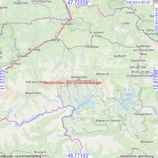
47° 15' 1.656" North, 12° 16' 33.06" East
| Map corner | latitude | longitude |
|---|---|---|
| Upper-left | 47.72559°, | 11.57273° |
| Center: | 47.25046°, | 12.27585° |
| Lower-right: | 46.77103°, | 12.97898° |
| Map W x H: | 106.1×106.1 km | = 65.9×65.9mi |
| max Lat: | 48.98333° ⇑68.8% North |
| Neukirchen am Großvenediger: | 47.25046° |
| min Lat: | ⇓31.2% South 46.48841° |
| min Long | Neukirchen am G | max Long |
| 9.57802° | 12.27585° | 17.1° |
| W 12.8%⇐ | ⇒87.2% E |
Elevation
Elevation of Neukirchen am Großvenediger is 851 m = 2792 ft, and this is 345.5 m = 1134 ft above average elevation for this country.
| Max E: |
2140 m = 7021 ft | 11.5% |
| Neukirchen am Großvenediger | 851 m 2792 ft | |
| Avg. | 505.5 m = 1658 ft | |
Min E: |
118 m = 387 ft | 88.5% |
See also: Austria elevation on elevation.city.
Geographical zone
Neukirchen am Großvenediger is located in North temperate zone (between Tropic of Cancer and the Arctic Circle). Distance of this North polar circle is 2147.4 km =1334.3 mi to North.| Distance of | km | miles | from Neukirchen am Großvenediger |
|---|---|---|---|
| North Pole | 4753.3 | 2953.6 | to North |
| Arctic Circle | 2147.4 | 1334.3 | to North |
| Tropic Cancer | 2647.8 | 1645.3 | to South |
| Equator | 5253.8 | 3264.6 | to South |


Nearby cities:
15 places around Neukirchen am Großvenediger: (largest is in red/bold)
• Aurach
21.3 km =13.2 mi,  32°
32°
• Bramberg am Wildkogel
5.2 km =3.2 mi,  65°
65°
• Burk
17 km =10.6 mi,  76°
76°
• Felben
16.1 km =10 mi, 76°
• Gerlos
18.8 km =11.7 mi,  261°
261°
• Hollersbach im Pinzgau
11.5 km =7.1 mi, 75°
• Jochberg
17.9 km =11.1 mi,  36°
36°
• Kelchsau
18.3 km =11.4 mi,  323°
323°
• Krimml
8.4 km =5.2 mi,  244°
244°
• Mittersill
16.1 km =10 mi, 76°
• Oberkrimml
9.1 km =5.7 mi,  245°
245°
• Rosenthal
2 km =1.2 mi,  268°
268°
• Stuhlfelden
19.4 km =12.1 mi, 77°
• Wald im Pinzgau
3.2 km =2 mi, 269°
• Westendorf
20.7 km =12.9 mi,  347°
347°
Sources, notices
• [Note1] Compared only with cities in Austria existing in our database
• [Src1] Map data: © OpenStreetMap contributors (CC-BY-SA)
• [Src2] Other city data from geonames.org with taken over terms of usage.
• [Src3] Geographical zone / Annual Mean Temperature by Robert A. Rohde @ Wikipedia
