Doppl geodata
Doppl (Upper Austria) is a seat of a third-order administrative division; located in Austria in Europe/Vienna (GMT+2) time zone. With population of 129 people, there are 2911 cities with bigger population in this country. Compared to other cities in Austria, 84.8% of cities are located further ↓South; 52.1% of cities are located further →East and 68.3% of cities have higher elevation than Doppl. Note1
Administrative division(s):
- Level 1: Upper Austria
- Level 2: Politischer Bezirk Perg
- Level 3: Schwertberg


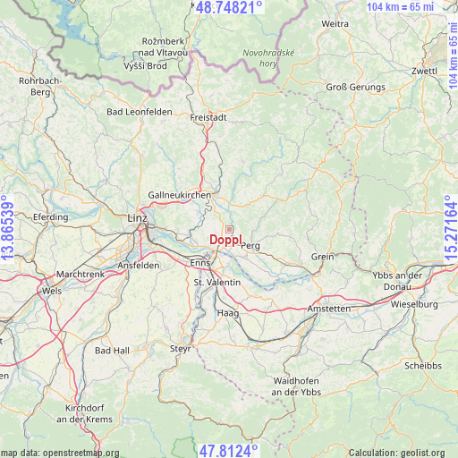
Doppl GPS coordinates[2]
48° 16' 56.82" North, 14° 34' 6.636" East
| Map corner | latitude | longitude |
|---|---|---|
| Upper-left | 48.74821°, | 13.86539° |
| Center: | 48.28245°, | 14.56851° |
| Lower-right: | 47.8124°, | 15.27164° |
| Map W x H: | 104.1×10⁴ km | = 64.7×64.6mi |
| max Lat: | 48.98333° ⇑15.2% North |
| Doppl: | 48.28245° |
| min Lat: | ⇓84.8% South 46.48841° |
| min Long | Doppl | max Long |
| 9.57802° | 14.56851° | 17.1° |
| W 47.9%⇐ | ⇒52.1% E |
Elevation
Elevation of Doppl is 337 m = 1106 ft, and this is 168.5 m = 553 ft below average elevation for this country.
| Max E: |
2140 m = 7021 ft | 68.3% |
| Avg. | 505.5 m = 1658 ft | |
| Doppl | 337 m = 1106 ft | |
Min E: |
118 m = 387 ft | 31.7% |
See also: Austria elevation on elevation.city.
Geographical zone
Doppl is located in North temperate zone (between Tropic of Cancer and the Arctic Circle). Distance of this North polar circle is 2032.7 km =1263.1 mi to North.| Distance of | km | miles | from Doppl |
|---|---|---|---|
| North Pole | 4638.6 | 2882.3 | to North |
| Arctic Circle | 2032.7 | 1263.1 | to North |
| Tropic Cancer | 2762.6 | 1716.6 | to South |
| Equator | 5368.5 | 3335.8 | to South |


Nearby cities:
15 places around Doppl: (largest is in red/bold)
• Allerheiligen im Mühlkreis
6.5 km =4 mi,  70°
70°
• Au an der Donau
6.1 km =3.8 mi,  169°
169°
• Blindendorf
6 km =3.7 mi,  261°
261°
• Heinrichsbrunn
5 km =3.1 mi,  209°
209°
• Langenstein
7.6 km =4.7 mi,  243°
243°
• Loitzenberg
1.6 km =1 mi,  227°
227°
• Mauthausen
5.8 km =3.6 mi,  218°
218°
• Naarn im Machlande
7 km =4.3 mi,  154°
154°
• Perg
6 km =3.7 mi,  126°
126°
• Ried in der Riedmark
3.3 km =2.1 mi,  247°
247°
• Schwertberg
1.6 km =1 mi, 129°
• Tragwein
6.9 km =4.3 mi,  35°
35°
• Ufer
6.3 km =3.9 mi, 233°
• Unterjosefstal
1.2 km =0.7 mi,  24°
24°
• Wasserburg
1 km =0.6 mi, 209°
Sources, notices
• [Note1] Compared only with cities in Austria existing in our database
• [Src1] Map data: © OpenStreetMap contributors (CC-BY-SA)
• [Src2] Other city data from geonames.org with taken over terms of usage.
• [Src3] Geographical zone / Annual Mean Temperature by Robert A. Rohde @ Wikipedia
