Unterjosefstal geodata
Unterjosefstal (Upper Austria) is a seat of a third-order administrative division; located in Austria in Europe/Vienna (GMT+2) time zone. With population of 8 people, there are 2954 cities with bigger population in this country. Compared to other cities in Austria, 85.5% of cities are located further ↓South; 52% of cities are located further →East and 81.5% of cities have higher elevation than Unterjosefstal. Note1
Administrative division(s):
- Level 1: Upper Austria
- Level 2: Politischer Bezirk Perg
- Level 3: Schwertberg


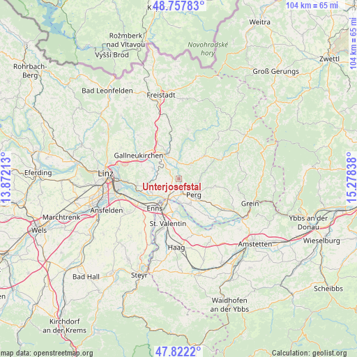
Unterjosefstal GPS coordinates[2]
48° 17' 31.776" North, 14° 34' 30.9" East
| Map corner | latitude | longitude |
|---|---|---|
| Upper-left | 48.75783°, | 13.87213° |
| Center: | 48.29216°, | 14.57525° |
| Lower-right: | 47.8222°, | 15.27838° |
| Map W x H: | 104×104 km | = 64.6×64.6mi |
| max Lat: | 48.98333° ⇑14.5% North |
| Unterjosefstal: | 48.29216° |
| min Lat: | ⇓85.5% South 46.48841° |
| min Long | Unterjosefstal | max Long |
| 9.57802° | 14.57525° | 17.1° |
| W 48%⇐ | ⇒52% E |
Elevation
Elevation of Unterjosefstal is 268 m = 879 ft, and this is 237.5 m = 779 ft below average elevation for this country.
| Max E: |
2140 m = 7021 ft | 81.5% |
| Avg. | 505.5 m = 1658 ft | |
| Unterjosefstal | 268 m = 879 ft | |
Min E: |
118 m = 387 ft | 18.5% |
See also: Austria elevation on elevation.city.
Geographical zone
Unterjosefstal is located in North temperate zone (between Tropic of Cancer and the Arctic Circle). Distance of this North polar circle is 2031.6 km =1262.4 mi to North.| Distance of | km | miles | from Unterjosefstal |
|---|---|---|---|
| North Pole | 4637.5 | 2881.6 | to North |
| Arctic Circle | 2031.6 | 1262.4 | to North |
| Tropic Cancer | 2763.7 | 1717.3 | to South |
| Equator | 5369.6 | 3336.5 | to South |


Nearby cities:
15 places around Unterjosefstal: (largest is in red/bold)
• Allerheiligen im Mühlkreis
5.7 km =3.5 mi,  78°
78°
• Au an der Donau
7.1 km =4.4 mi,  175°
175°
• Blindendorf
6.7 km =4.2 mi,  252°
252°
• Doppl
1.2 km =0.7 mi,  204°
204°
• Grünbichl
7.4 km =4.6 mi,  328°
328°
• Heinrichsbrunn
6.2 km =3.9 mi,  208°
208°
• Loitzenberg
2.7 km =1.7 mi,  218°
218°
• Mauthausen
7 km =4.3 mi, 215°
• Perg
6.4 km =4 mi,  137°
137°
• Pregarten
7.7 km =4.8 mi,  335°
335°
• Ried in der Riedmark
4.2 km =2.6 mi,  236°
236°
• Schwertberg
2.2 km =1.4 mi,  161°
161°
• Tragwein
5.7 km =3.5 mi,  37°
37°
• Ufer
7.4 km =4.6 mi,  228°
228°
• Wasserburg
2.2 km =1.4 mi, 207°
Sources, notices
• [Note1] Compared only with cities in Austria existing in our database
• [Src1] Map data: © OpenStreetMap contributors (CC-BY-SA)
• [Src2] Other city data from geonames.org with taken over terms of usage.
• [Src3] Geographical zone / Annual Mean Temperature by Robert A. Rohde @ Wikipedia
