Berg geodata
Berg (Carinthia) is a populated place; located in Austria in Europe/Vienna (GMT+2) time zone. With population of 738 people, there are 1753 cities with bigger population in this country. Compared to other cities in Austria, 93.7% of cities are located further ↑North; 80.8% of cities are located further →East and 82.3% of cities have lower elevation than Berg. Note1
Administrative division(s):
- Level 1: Carinthia
- Level 2: Politischer Bezirk Spittal an der Drau
- Level 3: Berg im Drautal


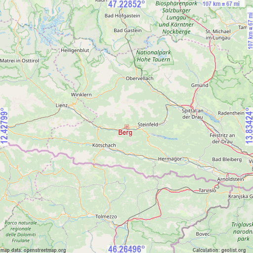
Berg GPS coordinates[2]
46° 44' 56.004" North, 13° 7' 51.996" East
| Map corner | latitude | longitude |
|---|---|---|
| Upper-left | 47.22852°, | 12.42799° |
| Center: | 46.74889°, | 13.13111° |
| Lower-right: | 46.26496°, | 13.83424° |
| Map W x H: | 107.1×107.1 km | = 66.5×66.5mi |
| max Lat: | 48.98333° ⇑93.7% North |
| Berg: | 46.74889° |
| min Lat: | ⇓6.3% South 46.48841° |
| min Long | Berg | max Long |
| 9.57802° | 13.13111° | 17.1° |
| W 19.2%⇐ | ⇒80.8% E |
Elevation
Elevation of Berg is 757 m = 2484 ft, and this is 251.5 m = 825 ft above average elevation for this country.
| Max E: |
2140 m = 7021 ft | 17.7% |
| Berg | 757 m 2484 ft | |
| Avg. | 505.5 m = 1658 ft | |
Min E: |
118 m = 387 ft | 82.3% |
See also: Austria elevation on elevation.city.
Geographical zone
Berg is located in North temperate zone (between Tropic of Cancer and the Arctic Circle). Distance of this North polar circle is 2203.2 km =1369 mi to North.| Distance of | km | miles | from Berg |
|---|---|---|---|
| North Pole | 4809.1 | 2988.2 | to North |
| Arctic Circle | 2203.2 | 1369 | to North |
| Tropic Cancer | 2592.1 | 1610.7 | to South |
| Equator | 5198 | 3229.9 | to South |


Nearby cities:
15 places around Berg: (largest is in red/bold)
• Berg im Drautal
0.3 km =0.2 mi,  84°
84°
• Dellach
10.5 km =6.5 mi,  202°
202°
• Dellach im Drautal
4.2 km =2.6 mi,  252°
252°
• Grafendorf
10.2 km =6.3 mi,  187°
187°
• Greifenburg
3.7 km =2.3 mi,  87°
87°
• Irschen
8.1 km =5 mi,  276°
276°
• Kirchbach
12.6 km =7.8 mi,  161°
161°
• Kötschach
12.1 km =7.5 mi,  231°
231°
• Lind
17.6 km =10.9 mi, 82°
• Mauthen
13.7 km =8.5 mi, 227°
• Nikolsdorf
17.1 km =10.6 mi, 283°
• Oberdrauburg
12.3 km =7.6 mi,  266°
266°
• Stall
17.3 km =10.7 mi,  335°
335°
• Steinfeld
9.1 km =5.7 mi, 83°
• Weissbriach
11.7 km =7.3 mi,  127°
127°
Sources, notices
• [Note1] Compared only with cities in Austria existing in our database
• [Src1] Map data: © OpenStreetMap contributors (CC-BY-SA)
• [Src2] Other city data from geonames.org with taken over terms of usage.
• [Src3] Geographical zone / Annual Mean Temperature by Robert A. Rohde @ Wikipedia
