Bachmanning geodata
Bachmanning (Upper Austria) is a seat of a third-order administrative division; located in Austria in Europe/Vienna (GMT+1) time zone. With population of 460 people, there are 2552 cities with bigger population in this country. Compared to other cities in Austria, 74.4% of cities are located further ↓South; 69.1% of cities are located further →East and 54.5% of cities have higher elevation than Bachmanning. Note1


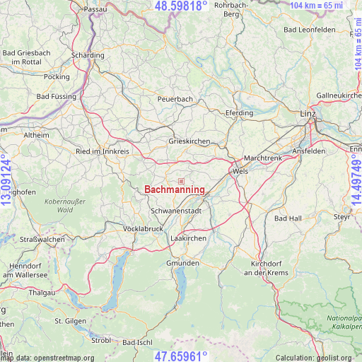
Bachmanning GPS coordinates[2]
48° 7' 51.744" North, 13° 47' 39.696" East
| Map corner | latitude | longitude |
|---|---|---|
| Upper-left | 48.59818°, | 13.09124° |
| Center: | 48.13104°, | 13.79436° |
| Lower-right: | 47.65961°, | 14.49749° |
| Map W x H: | 104.4×104.4 km | = 64.9×64.9mi |
| max Lat: | 48.98333° ⇑25.6% North |
| Bachmanning: | 48.13104° |
| min Lat: | ⇓74.4% South 46.48841° |
| min Long | Bachmanning | max Long |
| 9.57802° | 13.79436° | 17.1° |
| W 30.9%⇐ | ⇒69.1% E |
Elevation
Elevation of Bachmanning is 424 m = 1391 ft, and this is 81.5 m = 267 ft below average elevation for this country.
| Max E: |
2140 m = 7021 ft | 54.5% |
| Avg. | 505.5 m = 1658 ft | |
| Bachmanning | 424 m = 1391 ft | |
Min E: |
118 m = 387 ft | 45.5% |
See also: Austria elevation on elevation.city.
Geographical zone
Bachmanning is located in North temperate zone (between Tropic of Cancer and the Arctic Circle). Distance of this North polar circle is 2049.5 km =1273.5 mi to North.| Distance of | km | miles | from Bachmanning |
|---|---|---|---|
| North Pole | 4655.4 | 2892.7 | to North |
| Arctic Circle | 2049.5 | 1273.5 | to North |
| Tropic Cancer | 2745.8 | 1706.2 | to South |
| Equator | 5351.7 | 3325.4 | to South |


Nearby cities:
15 places around Bachmanning: (largest is in red/bold)
• Aichkirchen
2.4 km =1.5 mi,  184°
184°
• Aistersheim
7.3 km =4.5 mi,  327°
327°
• Edt bei Lambach
6.8 km =4.2 mi,  103°
103°
• Gaspoltshofen
4.5 km =2.8 mi,  287°
287°
• Kematen am Innbach
6.9 km =4.3 mi,  43°
43°
• Lambach
7.3 km =4.5 mi,  125°
125°
• Meggenhofen
5.5 km =3.4 mi,  1°
1°
• Neukirchen bei Lambach
3.8 km =2.4 mi,  154°
154°
• Niederthalheim
4 km =2.5 mi,  208°
208°
• Offenhausen
3.6 km =2.2 mi,  53°
53°
• Pennewang
4.1 km =2.5 mi,  86°
86°
• Schlatt
6.6 km =4.1 mi, 183°
• Stadl-Hausruck
6.9 km =4.3 mi,  141°
141°
• Stadl-Paura
7.5 km =4.7 mi, 134°
• Stadl-Traun
7.6 km =4.7 mi, 138°
Sources, notices
• [Note1] Compared only with cities in Austria existing in our database
• [Src1] Map data: © OpenStreetMap contributors (CC-BY-SA)
• [Src2] Other city data from geonames.org with taken over terms of usage.
• [Src3] Geographical zone / Annual Mean Temperature by Robert A. Rohde @ Wikipedia
