Groß-Schweinbarth geodata
Groß-Schweinbarth (Lower Austria) is a seat of a third-order administrative division; located in Austria in Europe/Vienna (GMT+2) time zone. With population of 1,245 people, there are 1009 cities with bigger population in this country. Compared to other cities in Austria, 91.3% of cities are located further ↓South; 96.3% of cities are located further ←West and 95.3% of cities have higher elevation than Groß-Schweinbarth. Note1
Administrative division(s):
- Level 1: Lower Austria
- Level 2: Politischer Bezirk Gänserndorf
- Level 3: Groß-Schweinbarth


Groß-Schweinbarth GPS coordinates[2]
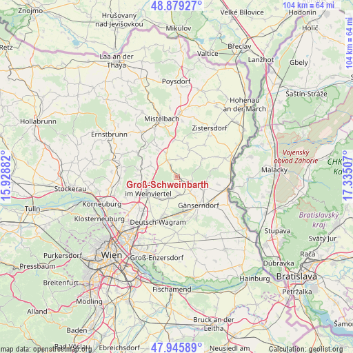
48° 24' 52.992" North, 16° 37' 54.984" East
| Map corner | latitude | longitude |
|---|---|---|
| Upper-left | 48.87927°, | 15.92882° |
| Center: | 48.41472°, | 16.63194° |
| Lower-right: | 47.94589°, | 17.33507° |
| Map W x H: | 103.8×103.8 km | = 64.5×64.5mi |
| max Lat: | 48.98333° ⇑8.7% North |
| Groß-Schweinbarth: | 48.41472° |
| min Lat: | ⇓91.3% South 46.48841° |
| min Long | Groß-Schweinba | max Long |
| 9.57802° | 16.63194° | 17.1° |
| W 96.3%⇐ | ⇒3.7% E |
Elevation
Elevation of Groß-Schweinbarth is 176 m = 577 ft, and this is 329.5 m = 1081 ft below average elevation for this country.
| Max E: |
2140 m = 7021 ft | 95.3% |
| Avg. | 505.5 m = 1658 ft | |
| Groß-Schweinbarth | 176 m = 577 ft | |
Min E: |
118 m = 387 ft | 4.7% |
See also: Austria elevation on elevation.city.
Geographical zone
Groß-Schweinbarth is located in North temperate zone (between Tropic of Cancer and the Arctic Circle). Distance of this North polar circle is 2018 km =1253.9 mi to North.| Distance of | km | miles | from Groß-Schweinbarth |
|---|---|---|---|
| North Pole | 4623.8 | 2873.1 | to North |
| Arctic Circle | 2018 | 1253.9 | to North |
| Tropic Cancer | 2777.3 | 1725.7 | to South |
| Equator | 5383.2 | 3345 | to South |


Nearby cities:
15 places around Groß-Schweinbarth: (largest is in red/bold)
• Auersthal
4.6 km =2.9 mi,  176°
176°
• Bad Pirawarth
4.8 km =3 mi,  329°
329°
• Bockfließ
6.4 km =4 mi,  198°
198°
• Gaweinstal
8 km =5 mi,  335°
335°
• Groß-Engersdorf
7.9 km =4.9 mi,  217°
217°
• Hochleithen
8.6 km =5.3 mi,  299°
299°
• Hohenruppersdorf
5.7 km =3.5 mi,  15°
15°
• Matzen
5.3 km =3.3 mi,  108°
108°
• Prottes
8.5 km =5.3 mi, 111°
• Raggendorf
3 km =1.9 mi,  139°
139°
• Schrick
9.5 km =5.9 mi,  353°
353°
• Schönkirchen-Reyersdorf
8 km =5 mi,  146°
146°
• Spannberg
9.5 km =5.9 mi,  54°
54°
• Wolfpassing an der Hochleithen
9.4 km =5.8 mi,  294°
294°
• Wolkersdorf im Weinviertel
9.2 km =5.7 mi,  247°
247°
Sources, notices
• [Note1] Compared only with cities in Austria existing in our database
• [Src1] Map data: © OpenStreetMap contributors (CC-BY-SA)
• [Src2] Other city data from geonames.org with taken over terms of usage.
• [Src3] Geographical zone / Annual Mean Temperature by Robert A. Rohde @ Wikipedia
