Hohenruppersdorf geodata
Hohenruppersdorf (Lower Austria) is a seat of a third-order administrative division; located in Austria in Europe/Vienna (GMT+2) time zone. With population of 910 people, there are 1414 cities with bigger population in this country. Compared to other cities in Austria, 93.2% of cities are located further ↓South; 96.8% of cities are located further ←West and 89.9% of cities have higher elevation than Hohenruppersdorf. Note1
Administrative division(s):
- Level 1: Lower Austria
- Level 2: Politischer Bezirk Gänserndorf
- Level 3: Hohenruppersdorf


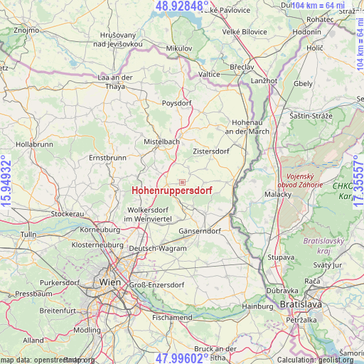
Hohenruppersdorf GPS coordinates[2]
48° 27' 51.804" North, 16° 39' 8.784" East
| Map corner | latitude | longitude |
|---|---|---|
| Upper-left | 48.92848°, | 15.94932° |
| Center: | 48.46439°, | 16.65244° |
| Lower-right: | 47.99602°, | 17.35557° |
| Map W x H: | 103.7×103.7 km | = 64.4×64.4mi |
| max Lat: | 48.98333° ⇑6.8% North |
| Hohenruppersdorf: | 48.46439° |
| min Lat: | ⇓93.2% South 46.48841° |
| min Long | Hohenruppersdor | max Long |
| 9.57802° | 16.65244° | 17.1° |
| W 96.8%⇐ | ⇒3.2% E |
Elevation
Elevation of Hohenruppersdorf is 213 m = 699 ft, and this is 292.5 m = 960 ft below average elevation for this country.
| Max E: |
2140 m = 7021 ft | 89.9% |
| Avg. | 505.5 m = 1658 ft | |
| Hohenruppersdorf | 213 m = 699 ft | |
Min E: |
118 m = 387 ft | 10.1% |
See also: Austria elevation on elevation.city.
Geographical zone
Hohenruppersdorf is located in North temperate zone (between Tropic of Cancer and the Arctic Circle). Distance of this North polar circle is 2012.4 km =1250.4 mi to North.| Distance of | km | miles | from Hohenruppersdorf |
|---|---|---|---|
| North Pole | 4618.3 | 2869.7 | to North |
| Arctic Circle | 2012.4 | 1250.4 | to North |
| Tropic Cancer | 2782.8 | 1729.2 | to South |
| Equator | 5388.7 | 3348.4 | to South |


Nearby cities:
15 places around Hohenruppersdorf: (largest is in red/bold)
• Auersthal
10.2 km =6.3 mi,  186°
186°
• Bad Pirawarth
4.2 km =2.6 mi,  250°
250°
• Ebenthal
10.3 km =6.4 mi,  109°
109°
• Gaweinstal
5.1 km =3.2 mi,  290°
290°
• Groß-Inzersdorf
10.5 km =6.5 mi,  49°
49°
• Groß-Schweinbarth
5.7 km =3.5 mi,  195°
195°
• Hochleithen
9 km =5.6 mi,  262°
262°
• Kettlasbrunn
9.5 km =5.9 mi,  358°
358°
• Loidesthal
7.5 km =4.7 mi,  73°
73°
• Matzen
8 km =5 mi,  153°
153°
• Obersulz
4.1 km =2.5 mi,  14°
14°
• Raggendorf
7.8 km =4.8 mi,  176°
176°
• Schrick
4.8 km =3 mi,  326°
326°
• Spannberg
6.2 km =3.9 mi,  90°
90°
• Wolfpassing an der Hochleithen
10.1 km =6.3 mi, 260°
Sources, notices
• [Note1] Compared only with cities in Austria existing in our database
• [Src1] Map data: © OpenStreetMap contributors (CC-BY-SA)
• [Src2] Other city data from geonames.org with taken over terms of usage.
• [Src3] Geographical zone / Annual Mean Temperature by Robert A. Rohde @ Wikipedia
