Auersbach geodata
Auersbach (Styria) is a seat of a third-order administrative division; located in Austria in Europe/Vienna (GMT+2) time zone. With population of 370 people, there are 2657 cities with bigger population in this country. Compared to other cities in Austria, 83.6% of cities are located further ↑North; 76.5% of cities are located further ←West and 60.9% of cities have higher elevation than Auersbach. Note1
Administrative division(s):
- Level 1: Styria
- Level 2: Politischer Bezirk Südoststeiermark
- Level 3: Feldbach


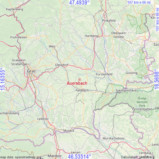
Auersbach GPS coordinates[2]
47° 1' 0.012" North, 15° 52' 0.012" East
| Map corner | latitude | longitude |
|---|---|---|
| Upper-left | 47.4939°, | 15.16355° |
| Center: | 47.01667°, | 15.86667° |
| Lower-right: | 46.53514°, | 16.5698° |
| Map W x H: | 106.6×106.6 km | = 66.2×66.2mi |
| max Lat: | 48.98333° ⇑83.6% North |
| Auersbach: | 47.01667° |
| min Lat: | ⇓16.4% South 46.48841° |
| min Long | Auersbach | max Long |
| 9.57802° | 15.86667° | 17.1° |
| W 76.5%⇐ | ⇒23.5% E |
Elevation
Elevation of Auersbach is 378 m = 1240 ft, and this is 127.5 m = 418 ft below average elevation for this country.
| Max E: |
2140 m = 7021 ft | 60.9% |
| Avg. | 505.5 m = 1658 ft | |
| Auersbach | 378 m = 1240 ft | |
Min E: |
118 m = 387 ft | 39.1% |
See also: Austria elevation on elevation.city.
Geographical zone
Auersbach is located in North temperate zone (between Tropic of Cancer and the Arctic Circle). Distance of this North polar circle is 2173.4 km =1350.5 mi to North.| Distance of | km | miles | from Auersbach |
|---|---|---|---|
| North Pole | 4779.3 | 2969.7 | to North |
| Arctic Circle | 2173.4 | 1350.5 | to North |
| Tropic Cancer | 2621.8 | 1629.1 | to South |
| Equator | 5227.8 | 3248.4 | to South |


Nearby cities:
15 places around Auersbach: (largest is in red/bold)
• Breitenfeld an der Rittschein
6.6 km =4.1 mi,  73°
73°
• Edelsbach bei Feldbach
3.8 km =2.4 mi,  216°
216°
• Feldbach
7.3 km =4.5 mi,  166°
166°
• Fladnitz im Raabtal
6.8 km =4.2 mi,  245°
245°
• Gniebing
6.1 km =3.8 mi,  187°
187°
• Hartmannsdorf
4.7 km =2.9 mi,  333°
333°
• Mitterfladnitz
4.9 km =3 mi,  262°
262°
• Nestelbach im Ilztal
7.4 km =4.6 mi,  0°
0°
• Oberstorcha
7.5 km =4.7 mi, 222°
• Ottendorf an der Rittschein
4 km =2.5 mi,  34°
34°
• Pöllau bei Gleisdorf
7.5 km =4.7 mi,  317°
317°
• Raabau
6.9 km =4.3 mi,  150°
150°
• Riegersburg
5.2 km =3.2 mi,  111°
111°
• Takern Zwei
7.8 km =4.8 mi,  283°
283°
• Unterweissenbach
7.5 km =4.7 mi, 189°
Sources, notices
• [Note1] Compared only with cities in Austria existing in our database
• [Src1] Map data: © OpenStreetMap contributors (CC-BY-SA)
• [Src2] Other city data from geonames.org with taken over terms of usage.
• [Src3] Geographical zone / Annual Mean Temperature by Robert A. Rohde @ Wikipedia
