Oberstorcha geodata
Oberstorcha (Styria) is a seat of a third-order administrative division; located in Austria in Europe/Vienna (GMT+2) time zone. With population of 146 people, there are 2899 cities with bigger population in this country. Compared to other cities in Austria, 85.6% of cities are located further ↑North; 74.6% of cities are located further ←West and 75.8% of cities have higher elevation than Oberstorcha. Note1
Administrative division(s):
- Level 1: Styria
- Level 2: Politischer Bezirk Südoststeiermark
- Level 3: Kirchberg an der Raab


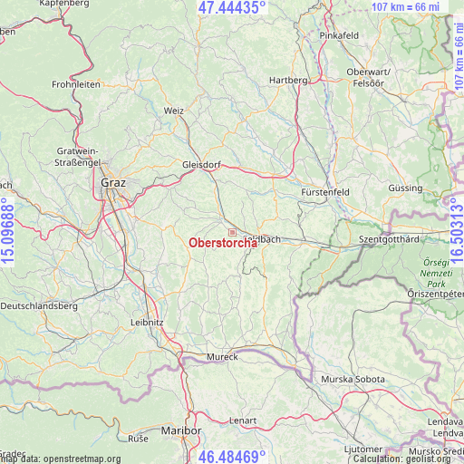
Oberstorcha GPS coordinates[2]
46° 58' 0.012" North, 15° 48' 0" East
| Map corner | latitude | longitude |
|---|---|---|
| Upper-left | 47.44435°, | 15.09688° |
| Center: | 46.96667°, | 15.8° |
| Lower-right: | 46.48469°, | 16.50313° |
| Map W x H: | 106.7×106.7 km | = 66.3×66.3mi |
| max Lat: | 48.98333° ⇑85.6% North |
| Oberstorcha: | 46.96667° |
| min Lat: | ⇓14.4% South 46.48841° |
| min Long | Oberstorcha | max Long |
| 9.57802° | 15.8° | 17.1° |
| W 74.6%⇐ | ⇒25.4% E |
Elevation
Elevation of Oberstorcha is 298 m = 978 ft, and this is 207.5 m = 681 ft below average elevation for this country.
| Max E: |
2140 m = 7021 ft | 75.8% |
| Avg. | 505.5 m = 1658 ft | |
| Oberstorcha | 298 m = 978 ft | |
Min E: |
118 m = 387 ft | 24.2% |
See also: Austria elevation on elevation.city.
Geographical zone
Oberstorcha is located in North temperate zone (between Tropic of Cancer and the Arctic Circle). Distance of this North polar circle is 2179 km =1354 mi to North.| Distance of | km | miles | from Oberstorcha |
|---|---|---|---|
| North Pole | 4784.9 | 2973.2 | to North |
| Arctic Circle | 2179 | 1354 | to North |
| Tropic Cancer | 2616.3 | 1625.7 | to South |
| Equator | 5222.2 | 3244.9 | to South |


Nearby cities:
15 places around Oberstorcha: (largest is in red/bold)
• Auersbach
7.5 km =4.7 mi,  42°
42°
• Baumgarten bei Gnas
6.1 km =3.8 mi,  204°
204°
• Edelsbach bei Feldbach
3.8 km =2.4 mi,  47°
47°
• Feldbach
6.9 km =4.3 mi,  102°
102°
• Fladnitz im Raabtal
3 km =1.9 mi,  338°
338°
• Gniebing
4.3 km =2.7 mi, 96°
• Kirchberg an der Raab
3.3 km =2.1 mi,  310°
310°
• Mitterfladnitz
4.9 km =3 mi,  2°
2°
• Oberdorf am Hochegg
6.1 km =3.8 mi,  282°
282°
• Oedt bei Feldbach
6 km =3.7 mi,  124°
124°
• Paldau
2.7 km =1.7 mi,  186°
186°
• Perlsdorf
6 km =3.7 mi,  169°
169°
• Studenzen
5.6 km =3.5 mi,  321°
321°
• Unterweissenbach
4.2 km =2.6 mi, 116°
• Wörth bei Kirchberg an der Raab
2.5 km =1.6 mi,  270°
270°
Sources, notices
• [Note1] Compared only with cities in Austria existing in our database
• [Src1] Map data: © OpenStreetMap contributors (CC-BY-SA)
• [Src2] Other city data from geonames.org with taken over terms of usage.
• [Src3] Geographical zone / Annual Mean Temperature by Robert A. Rohde @ Wikipedia
