Unterweissenbach geodata
Unterweissenbach (Styria) is a populated place; located in Austria in Europe/Vienna (GMT+2) time zone. With population of 679 people, there are 1904 cities with bigger population in this country. Compared to other cities in Austria, 86.4% of cities are located further ↑North; 76% of cities are located further ←West and 77.2% of cities have higher elevation than Unterweissenbach. Note1
Administrative division(s):
- Level 1: Styria
- Level 2: Politischer Bezirk Südoststeiermark
- Level 3: Feldbach


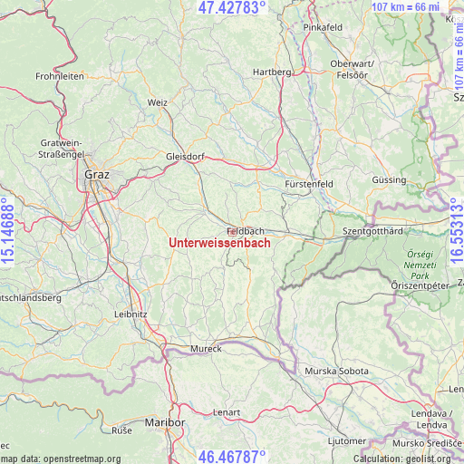
Unterweissenbach GPS coordinates[2]
46° 57' 0" North, 15° 51' 0" East
| Map corner | latitude | longitude |
|---|---|---|
| Upper-left | 47.42783°, | 15.14688° |
| Center: | 46.95°, | 15.85° |
| Lower-right: | 46.46787°, | 16.55313° |
| Map W x H: | 106.7×106.7 km | = 66.3×66.3mi |
| max Lat: | 48.98333° ⇑86.4% North |
| Unterweissenbach: | 46.95° |
| min Lat: | ⇓13.6% South 46.48841° |
| min Long | Unterweissenbac | max Long |
| 9.57802° | 15.85° | 17.1° |
| W 76%⇐ | ⇒24% E |
Elevation
Elevation of Unterweissenbach is 288 m = 945 ft, and this is 217.5 m = 714 ft below average elevation for this country.
| Max E: |
2140 m = 7021 ft | 77.2% |
| Avg. | 505.5 m = 1658 ft | |
| Unterweissenbach | 288 m = 945 ft | |
Min E: |
118 m = 387 ft | 22.8% |
See also: Austria elevation on elevation.city.
Geographical zone
Unterweissenbach is located in North temperate zone (between Tropic of Cancer and the Arctic Circle). Distance of this North polar circle is 2180.8 km =1355.1 mi to North.| Distance of | km | miles | from Unterweissenbach |
|---|---|---|---|
| North Pole | 4786.7 | 2974.3 | to North |
| Arctic Circle | 2180.8 | 1355.1 | to North |
| Tropic Cancer | 2614.4 | 1624.5 | to South |
| Equator | 5220.4 | 3243.8 | to South |


Nearby cities:
15 places around Unterweissenbach: (largest is in red/bold)
• Baumgarten bei Gnas
7.3 km =4.5 mi,  239°
239°
• Edelsbach bei Feldbach
4.5 km =2.8 mi,  347°
347°
• Feldbach
2.9 km =1.8 mi,  83°
83°
• Fladnitz im Raabtal
6.8 km =4.2 mi,  313°
313°
• Gniebing
1.5 km =0.9 mi,  19°
19°
• Leitersdorf im Raabtal
6.4 km =4 mi,  98°
98°
• Lödersdorf
7.1 km =4.4 mi, 82°
• Maierdorf
6.4 km =4 mi,  180°
180°
• Mühldorf bei Feldbach
4.5 km =2.8 mi,  106°
106°
• Oberstorcha
4.2 km =2.6 mi,  296°
296°
• Oedt bei Feldbach
1.9 km =1.2 mi,  143°
143°
• Paldau
4.2 km =2.6 mi,  258°
258°
• Perlsdorf
4.9 km =3 mi,  213°
213°
• Raabau
4.9 km =3 mi,  73°
73°
• Wörth bei Kirchberg an der Raab
6.6 km =4.1 mi,  286°
286°
Sources, notices
• [Note1] Compared only with cities in Austria existing in our database
• [Src1] Map data: © OpenStreetMap contributors (CC-BY-SA)
• [Src2] Other city data from geonames.org with taken over terms of usage.
• [Src3] Geographical zone / Annual Mean Temperature by Robert A. Rohde @ Wikipedia
