Vomperbach geodata
Vomperbach (Tyrol) is a populated place; located in Austria in Europe/Vienna (GMT+2) time zone. With population of 579 people, there are 2214 cities with bigger population in this country. Compared to other cities in Austria, 63.4% of cities are located further ↑North; 90.6% of cities are located further →East and 67.1% of cities have lower elevation than Vomperbach. Note1


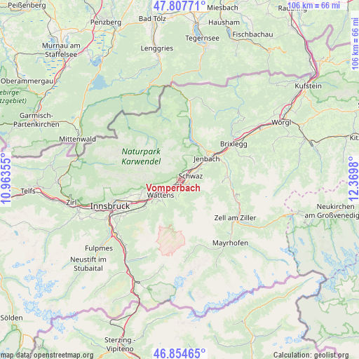
Vomperbach GPS coordinates[2]
47° 19' 59.988" North, 11° 40' 0.012" East
| Map corner | latitude | longitude |
|---|---|---|
| Upper-left | 47.80771°, | 10.96355° |
| Center: | 47.33333°, | 11.66667° |
| Lower-right: | 46.85465°, | 12.3698° |
| Map W x H: | 106×106 km | = 65.9×65.9mi |
| max Lat: | 48.98333° ⇑63.4% North |
| Vomperbach: | 47.33333° |
| min Lat: | ⇓36.6% South 46.48841° |
| min Long | Vomperbach | max Long |
| 9.57802° | 11.66667° | 17.1° |
| W 9.4%⇐ | ⇒90.6% E |
Elevation
Elevation of Vomperbach is 566 m = 1857 ft, and this is 60.5 m = 198 ft above average elevation for this country.
| Max E: |
2140 m = 7021 ft | 32.9% |
| Vomperbach | 566 m 1857 ft | |
| Avg. | 505.5 m = 1658 ft | |
Min E: |
118 m = 387 ft | 67.1% |
See also: Austria elevation on elevation.city.
Geographical zone
Vomperbach is located in North temperate zone (between Tropic of Cancer and the Arctic Circle). Distance of this North polar circle is 2138.2 km =1328.6 mi to North.| Distance of | km | miles | from Vomperbach |
|---|---|---|---|
| North Pole | 4744.1 | 2947.8 | to North |
| Arctic Circle | 2138.2 | 1328.6 | to North |
| Tropic Cancer | 2657.1 | 1651 | to South |
| Equator | 5263 | 3270.3 | to South |


Nearby cities:
15 places around Vomperbach: (largest is in red/bold)
• Fiecht
3.1 km =1.9 mi,  53°
53°
• Fritzens
6.6 km =4.1 mi,  241°
241°
• Gnadenwald
7.8 km =4.8 mi,  256°
256°
• Kolsass
4.5 km =2.8 mi,  214°
214°
• Kolsassberg
5.9 km =3.7 mi,  190°
190°
• Neu-Terfens
3.1 km =1.9 mi,  229°
229°
• Pill
1.5 km =0.9 mi,  136°
136°
• Schwaz
3.9 km =2.4 mi,  58°
58°
• Stans
5.3 km =3.3 mi, 45°
• Terfens
2 km =1.2 mi, 237°
• Vomp
1.3 km =0.8 mi,  90°
90°
• Wattenberg
7.5 km =4.7 mi,  222°
222°
• Wattens
7.2 km =4.5 mi, 232°
• Weer
3.7 km =2.3 mi, 206°
• Weerberg
3.9 km =2.4 mi,  180°
180°
Sources, notices
• [Note1] Compared only with cities in Austria existing in our database
• [Src1] Map data: © OpenStreetMap contributors (CC-BY-SA)
• [Src2] Other city data from geonames.org with taken over terms of usage.
• [Src3] Geographical zone / Annual Mean Temperature by Robert A. Rohde @ Wikipedia
