Königsberg geodata
Königsberg (Lower Austria) is a populated place; located in Austria in Europe/Vienna (GMT+2) time zone. With population of 588 people, there are 2175 cities with bigger population in this country. Compared to other cities in Austria, 50.4% of cities are located further ↑North; 84.2% of cities are located further ←West and 80.8% of cities have lower elevation than Königsberg. Note1
Administrative division(s):
- Level 1: Lower Austria
- Level 2: Politischer Bezirk Neunkirchen
- Level 3: Thomasberg


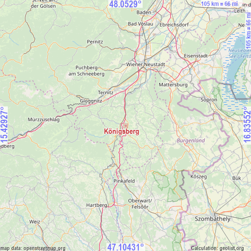
Königsberg GPS coordinates[2]
47° 34' 50.7" North, 16° 7' 56.604" East
| Map corner | latitude | longitude |
|---|---|---|
| Upper-left | 48.0529°, | 15.42927° |
| Center: | 47.58075°, | 16.13239° |
| Lower-right: | 47.10431°, | 16.83552° |
| Map W x H: | 105.5×105.5 km | = 65.6×65.6mi |
| max Lat: | 48.98333° ⇑50.4% North |
| Königsberg: | 47.58075° |
| min Lat: | ⇓49.6% South 46.48841° |
| min Long | Königsberg | max Long |
| 9.57802° | 16.13239° | 17.1° |
| W 84.2%⇐ | ⇒15.8% E |
Elevation
Elevation of Königsberg is 731 m = 2398 ft, and this is 225.5 m = 740 ft above average elevation for this country.
| Max E: |
2140 m = 7021 ft | 19.2% |
| Königsberg | 731 m 2398 ft | |
| Avg. | 505.5 m = 1658 ft | |
Min E: |
118 m = 387 ft | 80.8% |
See also: Austria elevation on elevation.city.
Geographical zone
Königsberg is located in North temperate zone (between Tropic of Cancer and the Arctic Circle). Distance of this North polar circle is 2110.7 km =1311.5 mi to North.| Distance of | km | miles | from Königsberg |
|---|---|---|---|
| North Pole | 4716.6 | 2930.8 | to North |
| Arctic Circle | 2110.7 | 1311.5 | to North |
| Tropic Cancer | 2684.6 | 1668.1 | to South |
| Equator | 5290.5 | 3287.4 | to South |


Nearby cities:
15 places around Königsberg: (largest is in red/bold)
• Aspang Markt
5 km =3.1 mi,  227°
227°
• Edlitz
2 km =1.2 mi,  17°
17°
• Feistritz am Wechsel
6.5 km =4 mi,  289°
289°
• Grimmenstein
4 km =2.5 mi,  354°
354°
• Hollenthon
9.7 km =6 mi,  84°
84°
• Krumbach Markt
8.1 km =5 mi,  151°
151°
• Lichtenegg
5.5 km =3.4 mi,  67°
67°
• Mönichkirchen
10.7 km =6.6 mi,  223°
223°
• Sankt Corona am Wechsel
9.9 km =6.2 mi,  271°
271°
• Scheiblingkirchen
9 km =5.6 mi,  0°
0°
• Thernberg
8.6 km =5.3 mi,  26°
26°
• Thomasberg
1.6 km =1 mi,  177°
177°
• Tiefenbach
7.9 km =4.9 mi,  129°
129°
• Warth
7.8 km =4.8 mi, 351°
• Zöbern
7.4 km =4.6 mi, 180°
Sources, notices
• [Note1] Compared only with cities in Austria existing in our database
• [Src1] Map data: © OpenStreetMap contributors (CC-BY-SA)
• [Src2] Other city data from geonames.org with taken over terms of usage.
• [Src3] Geographical zone / Annual Mean Temperature by Robert A. Rohde @ Wikipedia
