Thernberg geodata
Thernberg (Lower Austria) is a populated place; located in Austria in Europe/Vienna (GMT+1) time zone. With population of 623 people, there are 2055 cities with bigger population in this country. Compared to other cities in Austria, 51.9% of cities are located further ↓South; 85.6% of cities are located further ←West and 57.3% of cities have lower elevation than Thernberg. Note1
Administrative division(s):
- Level 1: Lower Austria
- Level 2: Politischer Bezirk Neunkirchen
- Level 3: Scheiblingkirchen-Thernberg


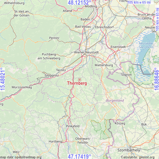
Thernberg GPS coordinates[2]
47° 39' 0" North, 16° 10' 59.988" East
| Map corner | latitude | longitude |
|---|---|---|
| Upper-left | 48.12152°, | 15.48021° |
| Center: | 47.65°, | 16.18333° |
| Lower-right: | 47.17419°, | 16.88646° |
| Map W x H: | 105.3×105.3 km | = 65.4×65.4mi |
| max Lat: | 48.98333° ⇑48.1% North |
| Thernberg: | 47.65° |
| min Lat: | ⇓51.9% South 46.48841° |
| min Long | Thernberg | max Long |
| 9.57802° | 16.18333° | 17.1° |
| W 85.6%⇐ | ⇒14.4% E |
Elevation
Elevation of Thernberg is 500 m = 1640 ft, and this is 5.5 m = 18 ft below average elevation for this country.
| Max E: |
2140 m = 7021 ft | 42.7% |
| Avg. | 505.5 m = 1658 ft | |
| Thernberg | 500 m = 1640 ft | |
Min E: |
118 m = 387 ft | 57.3% |
See also: Austria elevation on elevation.city.
Geographical zone
Thernberg is located in North temperate zone (between Tropic of Cancer and the Arctic Circle). Distance of this North polar circle is 2103 km =1306.7 mi to North.| Distance of | km | miles | from Thernberg |
|---|---|---|---|
| North Pole | 4708.9 | 2926 | to North |
| Arctic Circle | 2103 | 1306.7 | to North |
| Tropic Cancer | 2692.3 | 1672.9 | to South |
| Equator | 5298.2 | 3292.1 | to South |


Nearby cities:
15 places around Thernberg: (largest is in red/bold)
• Bad Erlach
8.9 km =5.5 mi,  15°
15°
• Bromberg
2.6 km =1.6 mi,  49°
49°
• Edlitz
6.6 km =4.1 mi,  209°
209°
• Grimmenstein
5.6 km =3.5 mi,  228°
228°
• Hochwolkersdorf
7.4 km =4.6 mi,  80°
80°
• Hollenthon
8.9 km =5.5 mi,  139°
139°
• Königsberg
8.6 km =5.3 mi, 206°
• Lichtenegg
5.7 km =3.5 mi,  167°
167°
• Pitten
7.4 km =4.6 mi,  0°
0°
• Scheiblingkirchen
3.9 km =2.4 mi,  289°
289°
• Schlatten
5 km =3.1 mi,  90°
90°
• Seebenstein
6.2 km =3.9 mi,  332°
332°
• Walpersbach
8.3 km =5.2 mi,  26°
26°
• Warth
5 km =3.1 mi,  270°
270°
• Wiesmath
8.4 km =5.2 mi,  116°
116°
Sources, notices
• [Note1] Compared only with cities in Austria existing in our database
• [Src1] Map data: © OpenStreetMap contributors (CC-BY-SA)
• [Src2] Other city data from geonames.org with taken over terms of usage.
• [Src3] Geographical zone / Annual Mean Temperature by Robert A. Rohde @ Wikipedia
