Summertown geodata
Summertown (South Australia) is a populated place; located in Australia in Australia/Adelaide (GMT+10.5) time zone. With population of 670 people, there are 4382 cities with bigger population in this country. Compared to other cities in Australia, 70.2% of cities are located further ↑North; 77.8% of cities are located further →East and 93.9% of cities have lower elevation than Summertown. Note1


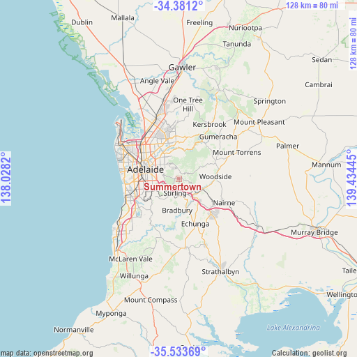
Summertown GPS coordinates[2]
34° 57' 34.092" South, 138° 43' 52.752" East
| Map corner | latitude | longitude |
|---|---|---|
| Upper-left | -34.3812°, | 138.0282° |
| Center: | -34.95947°, | 138.73132° |
| Lower-right: | -35.53369°, | 139.43445° |
| Map W x H: | 128.1×128.1 km | = 79.6×79.6mi |
| max Lat: | -10.58257° ⇑70.2% North |
| Summertown: | -34.95947° |
| min Lat: | ⇓29.8% South -43.31423° |
| min Long | Summertown | max Long |
| 113.53327° | 138.73132° | 153.61246° |
| W 22.2%⇐ | ⇒77.8% E |
Elevation
Elevation of Summertown is 532 m = 1745 ft, and this is 410 m = 1345 ft above average elevation for this country.
| Max E: |
1715 m = 5627 ft | 6.1% |
| Summertown | 532 m 1745 ft | |
| Avg. | 122 m = 400 ft | |
Min E: |
-2 m = -7 ft | 93.9% |
See also: Australia elevation on elevation.city.
Geographical zone
Summertown is located in South temperate zone (between Tropic of Capricorn and the Antarctic Circle). Distance of this Southern Tropic circle is 1281.2 km =796.1 mi to North.| Distance of | km | miles | from Summertown |
|---|---|---|---|
| Equator | 3887.1 | 2415.3 | to North |
| Tropic Capricorn | 1281.2 | 796.1 | to North |
| Antarctic Circle | 3514 | 2183.5 | to South |
| South Pole | 6119.9 | 3802.7 | to South |


Nearby cities:
15 places around Summertown: (largest is in red/bold)
• Adelaide Hills
5.8 km =3.6 mi,  337°
337°
• Aldgate
6.4 km =4 mi,  178°
178°
• Auldana
6.1 km =3.8 mi,  318°
318°
• Beaumont
6.4 km =4 mi,  280°
280°
• Bridgewater
6.9 km =4.3 mi,  152°
152°
• Crafers
5.3 km =3.3 mi,  212°
212°
• Crafers West
5.7 km =3.5 mi,  231°
231°
• Hazelwood Park
7 km =4.3 mi,  288°
288°
• Norton Summit
4.1 km =2.5 mi,  351°
351°
• Rosslyn Park
6.6 km =4.1 mi,  309°
309°
• Stirling
4.9 km =3 mi,  192°
192°
• Stonyfell
5.7 km =3.5 mi,  299°
299°
• Teringie
5.7 km =3.5 mi,  332°
332°
• Uraidla
1.3 km =0.8 mi,  71°
71°
• Wattle Park
6.4 km =4 mi, 306°
Sources, notices
• [Note1] Compared only with cities in Australia existing in our database
• [Src1] Map data: © OpenStreetMap contributors (CC-BY-SA)
• [Src2] Other city data from geonames.org with taken over terms of usage.
• [Src3] Geographical zone / Annual Mean Temperature by Robert A. Rohde @ Wikipedia
