Meekatharra geodata
Meekatharra (Western Australia) is a populated place; located in Australia in Australia/Perth (GMT+8) time zone. With population of 962 people, there are 3878 cities with bigger population in this country. Compared to other cities in Australia, 87.3% of cities are located further ↓South; 89.6% of cities are located further →East and 93.7% of cities have lower elevation than Meekatharra. Note1


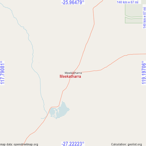
Meekatharra GPS coordinates[2]
26° 35' 42.864" South, 118° 29' 38.148" East
| Map corner | latitude | longitude |
|---|---|---|
| Upper-left | -25.96479°, | 117.79081° |
| Center: | -26.59524°, | 118.49393° |
| Lower-right: | -27.22223°, | 119.19706° |
| Map W x H: | 139.8×139.8 km | = 86.9×86.9mi |
| max Lat: | -10.58257° ⇑12.7% North |
| Meekatharra: | -26.59524° |
| min Lat: | ⇓87.3% South -43.31423° |
| min Long | Meekatharra | max Long |
| 113.53327° | 118.49393° | 153.61246° |
| W 10.4%⇐ | ⇒89.6% E |
Elevation
Elevation of Meekatharra is 518 m = 1699 ft, and this is 396 m = 1299 ft above average elevation for this country.
| Max E: |
1715 m = 5627 ft | 6.3% |
| Meekatharra | 518 m 1699 ft | |
| Avg. | 122 m = 400 ft | |
Min E: |
-2 m = -7 ft | 93.7% |
See also: Australia elevation on elevation.city.
Geographical zone
Meekatharra is located in South temperate zone (between Tropic of Capricorn and the Antarctic Circle). Distance of this Southern Tropic circle is 351.2 km =218.2 mi to North.| Distance of | km | miles | from Meekatharra |
|---|---|---|---|
| Equator | 2957.1 | 1837.5 | to North |
| Tropic Capricorn | 351.2 | 218.2 | to North |
| Antarctic Circle | 4444.1 | 2761.4 | to South |
| South Pole | 7049.9 | 4380.6 | to South |


Nearby cities:
11 places around Meekatharra: (largest is in red/bold)
• Leinster
262.9 km =163.4 mi,  124°
124°
• Leonora
377.8 km =234.8 mi,  132°
132°
• Melville
247.8 km =154 mi,  224°
224°
• Morawa
380 km =236.1 mi, 219°
• Mount Magnet
175.4 km =109 mi,  201°
201°
• Mullewa
364.9 km =226.7 mi,  233°
233°
• Newman
381.2 km =236.9 mi,  19°
19°
• Paraburdoo
386.1 km =239.9 mi,  347°
347°
• Tom Price
439.5 km =273.1 mi, 350°
• Wiluna
172 km =106.9 mi,  89°
89°
• Yalgoo
264 km =164 mi, 222°
Sources, notices
• [Note1] Compared only with cities in Australia existing in our database
• [Src1] Map data: © OpenStreetMap contributors (CC-BY-SA)
• [Src2] Other city data from geonames.org with taken over terms of usage.
• [Src3] Geographical zone / Annual Mean Temperature by Robert A. Rohde @ Wikipedia
