Lake Grace geodata
Lake Grace (Western Australia) is a populated place; located in Australia in Australia/Perth (GMT+8) time zone. With population of 544 people, there are 4725 cities with bigger population in this country. Compared to other cities in Australia, 56.7% of cities are located further ↓South; 89.6% of cities are located further →East and 87% of cities have lower elevation than Lake Grace. Note1


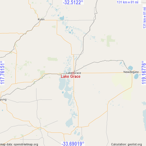
Lake Grace GPS coordinates[2]
33° 6' 11.412" South, 118° 27' 52.668" East
| Map corner | latitude | longitude |
|---|---|---|
| Upper-left | -32.5122°, | 117.76151° |
| Center: | -33.10317°, | 118.46463° |
| Lower-right: | -33.69019°, | 119.16776° |
| Map W x H: | 131×131 km | = 81.4×81.4mi |
| max Lat: | -10.58257° ⇑43.3% North |
| Lake Grace: | -33.10317° |
| min Lat: | ⇓56.7% South -43.31423° |
| min Long | Lake Grace | max Long |
| 113.53327° | 118.46463° | 153.61246° |
| W 10.4%⇐ | ⇒89.6% E |
Elevation
Elevation of Lake Grace is 286 m = 938 ft, and this is 164 m = 538 ft above average elevation for this country.
| Max E: |
1715 m = 5627 ft | 13% |
| Lake Grace | 286 m 938 ft | |
| Avg. | 122 m = 400 ft | |
Min E: |
-2 m = -7 ft | 87% |
See also: Australia elevation on elevation.city.
Geographical zone
Lake Grace is located in South temperate zone (between Tropic of Capricorn and the Antarctic Circle). Distance of this Southern Tropic circle is 1074.8 km =667.8 mi to North.| Distance of | km | miles | from Lake Grace |
|---|---|---|---|
| Equator | 3680.7 | 2287.1 | to North |
| Tropic Capricorn | 1074.8 | 667.8 | to North |
| Antarctic Circle | 3720.4 | 2311.7 | to South |
| South Pole | 6326.3 | 3931 | to South |


Nearby cities:
15 places around Lake Grace: (largest is in red/bold)
• Brookton
158.4 km =98.4 mi,  300°
300°
• Bruce Rock
139.2 km =86.5 mi,  347°
347°
• Corrigin
101.9 km =63.3 mi,  327°
327°
• Gnowangerup
101.9 km =63.3 mi,  204°
204°
• Hopetoun
180.6 km =112.2 mi,  121°
121°
• Katanning
106.3 km =66.1 mi,  232°
232°
• Kellerberrin
177.9 km =110.5 mi,  336°
336°
• Kendenup
171.8 km =106.8 mi,  206°
206°
• Kojonup
145.6 km =90.5 mi,  236°
236°
• Narrogin
121.5 km =75.5 mi,  278°
278°
• Pingelly
143.9 km =89.4 mi, 296°
• Quairading
157.3 km =97.7 mi,  320°
320°
• Ravensthorpe
156.4 km =97.2 mi,  109°
109°
• Wagin
106.8 km =66.4 mi,  257°
257°
• Williams
148 km =92 mi,  273°
273°
Sources, notices
• [Note1] Compared only with cities in Australia existing in our database
• [Src1] Map data: © OpenStreetMap contributors (CC-BY-SA)
• [Src2] Other city data from geonames.org with taken over terms of usage.
• [Src3] Geographical zone / Annual Mean Temperature by Robert A. Rohde @ Wikipedia
