Hopetoun geodata
Hopetoun (Western Australia) is a populated place; located in Australia in Australia/Perth (GMT+8) time zone. With population of 801 people, there are 4145 cities with bigger population in this country. Compared to other cities in Australia, 57.8% of cities are located further ↑North; 89.4% of cities are located further →East and 85% of cities have higher elevation than Hopetoun. Note1


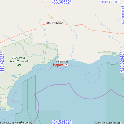
Hopetoun GPS coordinates[2]
33° 57' 2.052" South, 120° 7' 34.86" East
| Map corner | latitude | longitude |
|---|---|---|
| Upper-left | -33.36532°, | 119.42323° |
| Center: | -33.95057°, | 120.12635° |
| Lower-right: | -34.53182°, | 120.82948° |
| Map W x H: | 129.7×129.7 km | = 80.6×80.6mi |
| max Lat: | -10.58257° ⇑57.8% North |
| Hopetoun: | -33.95057° |
| min Lat: | ⇓42.2% South -43.31423° |
| min Long | Hopetoun | max Long |
| 113.53327° | 120.12635° | 153.61246° |
| W 10.6%⇐ | ⇒89.4% E |
Elevation
Elevation of Hopetoun is 12 m = 39 ft, and this is 110 m = 361 ft below average elevation for this country.
| Max E: |
1715 m = 5627 ft | 85% |
| Avg. | 122 m = 400 ft | |
| Hopetoun | 12 m = 39 ft | |
Min E: |
-2 m = -7 ft | 15% |
See also: Australia elevation on elevation.city.
Geographical zone
Hopetoun is located in South temperate zone (between Tropic of Capricorn and the Antarctic Circle). Distance of this Southern Tropic circle is 1169 km =726.4 mi to North.| Distance of | km | miles | from Hopetoun |
|---|---|---|---|
| Equator | 3774.9 | 2345.6 | to North |
| Tropic Capricorn | 1169 | 726.4 | to North |
| Antarctic Circle | 3626.2 | 2253.2 | to South |
| South Pole | 6232.1 | 3872.4 | to South |


Nearby cities:
15 places around Hopetoun: (largest is in red/bold)
• Bayonet Head
230.9 km =143.5 mi,  240°
240°
• Castletown
165.7 km =103 mi,  85°
85°
• Collingwood Heights
233 km =144.8 mi, 240°
• Esperance
163.2 km =101.4 mi, 86°
• Gnowangerup
195.3 km =121.4 mi,  270°
270°
• Kalgan
219.9 km =136.6 mi, 241°
• Lake Grace
180.6 km =112.2 mi,  301°
301°
• Lower King
229.7 km =142.7 mi, 240°
• Nulsen
161.7 km =100.5 mi, 86°
• Pink Lake
160.3 km =99.6 mi, 86°
• Ravensthorpe
41.5 km =25.8 mi,  349°
349°
• Sinclair
161.4 km =100.3 mi, 86°
• Spencer Park
235.3 km =146.2 mi, 240°
• West Beach
163 km =101.3 mi, 87°
• Willyung
233.7 km =145.2 mi, 241°
Sources, notices
• [Note1] Compared only with cities in Australia existing in our database
• [Src1] Map data: © OpenStreetMap contributors (CC-BY-SA)
• [Src2] Other city data from geonames.org with taken over terms of usage.
• [Src3] Geographical zone / Annual Mean Temperature by Robert A. Rohde @ Wikipedia
