Woodhill geodata
Woodhill (Queensland) is a populated place; located in Australia in Australia/Brisbane (GMT+10) time zone. With population of 724 people, there are 4288 cities with bigger population in this country. Compared to other cities in Australia, 76.7% of cities are located further ↓South; 90% of cities are located further ←West and 53.1% of cities have higher elevation than Woodhill. Note1


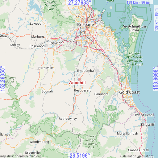
Woodhill GPS coordinates[2]
27° 54' 0" South, 152° 58' 0.012" East
| Map corner | latitude | longitude |
|---|---|---|
| Upper-left | -27.27683°, | 152.26355° |
| Center: | -27.9°, | 152.96667° |
| Lower-right: | -28.5196°, | 153.6698° |
| Map W x H: | 138.2×138.2 km | = 85.9×85.9mi |
| max Lat: | -10.58257° ⇑23.3% North |
| Woodhill: | -27.9° |
| min Lat: | ⇓76.7% South -43.31423° |
| min Long | Woodhill | max Long |
| 113.53327° | 152.96667° | 153.61246° |
| W 90%⇐ | ⇒10% E |
Elevation
Elevation of Woodhill is 41 m = 135 ft, and this is 81 m = 266 ft below average elevation for this country.
| Max E: |
1715 m = 5627 ft | 53.1% |
| Avg. | 122 m = 400 ft | |
| Woodhill | 41 m = 135 ft | |
Min E: |
-2 m = -7 ft | 46.9% |
See also: Australia elevation on elevation.city.
Geographical zone
Woodhill is located in South temperate zone (between Tropic of Capricorn and the Antarctic Circle). Distance of this Southern Tropic circle is 496.3 km =308.4 mi to North.| Distance of | km | miles | from Woodhill |
|---|---|---|---|
| Equator | 3102.2 | 1927.6 | to North |
| Tropic Capricorn | 496.3 | 308.4 | to North |
| Antarctic Circle | 4299 | 2671.3 | to South |
| South Pole | 6904.9 | 4290.5 | to South |


Nearby cities:
15 places around Woodhill: (largest is in red/bold)
• Beaudesert
10.1 km =6.3 mi,  163°
163°
• Boyland
17.3 km =10.7 mi,  108°
108°
• Cedar Grove
4.1 km =2.5 mi,  23°
23°
• Cedar Vale
6.2 km =3.9 mi,  78°
78°
• Chambers Flat
20.1 km =12.5 mi,  32°
32°
• Gleneagle
4.1 km =2.5 mi, 156°
• Jimboomba
9.7 km =6 mi,  37°
37°
• Mundoolun
10.3 km =6.4 mi,  89°
89°
• Munruben
18.2 km =11.3 mi, 20°
• New Beith
14.3 km =8.9 mi,  325°
325°
• North Maclean
15.5 km =9.6 mi, 18°
• South Maclean
12.9 km =8 mi, 22°
• Stockleigh
17.8 km =11.1 mi, 33°
• Tamborine
16.5 km =10.3 mi, 83°
• Yarrabilba
17.5 km =10.9 mi,  54°
54°
Sources, notices
• [Note1] Compared only with cities in Australia existing in our database
• [Src1] Map data: © OpenStreetMap contributors (CC-BY-SA)
• [Src2] Other city data from geonames.org with taken over terms of usage.
• [Src3] Geographical zone / Annual Mean Temperature by Robert A. Rohde @ Wikipedia
