Mundoolun geodata
Mundoolun (Queensland) is a section of populated place; located in Australia in Australia/Brisbane (GMT+10) time zone. With population of 1,518 people, there are 3266 cities with bigger population in this country. Compared to other cities in Australia, 76.7% of cities are located further ↓South; 93.9% of cities are located further ←West and 72% of cities have lower elevation than Mundoolun. Note1


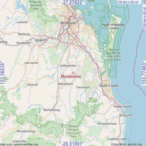
Mundoolun GPS coordinates[2]
27° 53' 57.84" South, 153° 4' 17.4" East
| Map corner | latitude | longitude |
|---|---|---|
| Upper-left | -27.27622°, | 152.36838° |
| Center: | -27.8994°, | 153.0715° |
| Lower-right: | -28.51901°, | 153.77463° |
| Map W x H: | 138.2×138.2 km | = 85.9×85.9mi |
| max Lat: | -10.58257° ⇑23.3% North |
| Mundoolun: | -27.8994° |
| min Lat: | ⇓76.7% South -43.31423° |
| min Long | Mundoolun | max Long |
| 113.53327° | 153.0715° | 153.61246° |
| W 93.9%⇐ | ⇒6.1% E |
Elevation
Elevation of Mundoolun is 112 m = 367 ft, and this is 10 m = 33 ft below average elevation for this country.
| Max E: |
1715 m = 5627 ft | 28% |
| Avg. | 122 m = 400 ft | |
| Mundoolun | 112 m = 367 ft | |
Min E: |
-2 m = -7 ft | 72% |
See also: Australia elevation on elevation.city.
Geographical zone
Mundoolun is located in South temperate zone (between Tropic of Capricorn and the Antarctic Circle). Distance of this Southern Tropic circle is 496.2 km =308.3 mi to North.| Distance of | km | miles | from Mundoolun |
|---|---|---|---|
| Equator | 3102.1 | 1927.6 | to North |
| Tropic Capricorn | 496.2 | 308.3 | to North |
| Antarctic Circle | 4299.1 | 2671.3 | to South |
| South Pole | 6904.9 | 4290.5 | to South |


Nearby cities:
15 places around Mundoolun: (largest is in red/bold)
• Beaudesert
12.2 km =7.6 mi,  217°
217°
• Boyland
8.3 km =5.2 mi,  132°
132°
• Cedar Creek
13.3 km =8.3 mi,  71°
71°
• Cedar Grove
9.4 km =5.8 mi,  292°
292°
• Cedar Vale
4.3 km =2.7 mi, 285°
• Gleneagle
9.4 km =5.8 mi,  246°
246°
• Jimboomba
8.7 km =5.4 mi,  330°
330°
• Logan Village
15 km =9.3 mi,  13°
13°
• North Maclean
15.6 km =9.7 mi,  339°
339°
• South Maclean
13.1 km =8.1 mi, 335°
• Stockleigh
14.8 km =9.2 mi,  358°
358°
• Tamborine
6.3 km =3.9 mi, 73°
• Tamborine Mountain
14.8 km =9.2 mi,  121°
121°
• Woodhill
10.3 km =6.4 mi,  269°
269°
• Yarrabilba
10.8 km =6.7 mi,  21°
21°
Sources, notices
• [Note1] Compared only with cities in Australia existing in our database
• [Src1] Map data: © OpenStreetMap contributors (CC-BY-SA)
• [Src2] Other city data from geonames.org with taken over terms of usage.
• [Src3] Geographical zone / Annual Mean Temperature by Robert A. Rohde @ Wikipedia
