Walcha geodata
Walcha (New South Wales) is a populated place; located in Australia in Australia/Sydney (GMT+11) time zone. With population of 2,538 people, there are 2540 cities with bigger population in this country. Compared to other cities in Australia, 70.8% of cities are located further ↓South; 78.8% of cities are located further ←West and 99.8% of cities have lower elevation than Walcha. Note1


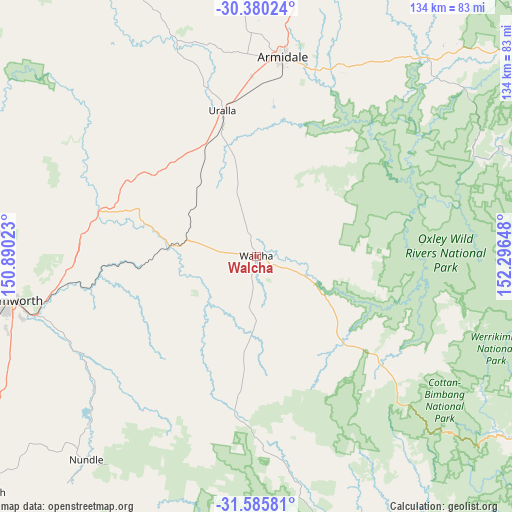
Walcha GPS coordinates[2]
30° 59' 5.748" South, 151° 35' 36.06" East
| Map corner | latitude | longitude |
|---|---|---|
| Upper-left | -30.38024°, | 150.89023° |
| Center: | -30.98493°, | 151.59335° |
| Lower-right: | -31.58581°, | 152.29648° |
| Map W x H: | 134×134 km | = 83.3×83.3mi |
| max Lat: | -10.58257° ⇑29.2% North |
| Walcha: | -30.98493° |
| min Lat: | ⇓70.8% South -43.31423° |
| min Long | Walcha | max Long |
| 113.53327° | 151.59335° | 153.61246° |
| W 78.8%⇐ | ⇒21.2% E |
Elevation
Elevation of Walcha is 1047 m = 3435 ft, and this is 925 m = 3035 ft above average elevation for this country.
| Max E: |
1715 m = 5627 ft | 0.2% |
| Walcha | 1047 m 3435 ft | |
| Avg. | 122 m = 400 ft | |
Min E: |
-2 m = -7 ft | 99.8% |
See also: Australia elevation on elevation.city.
Geographical zone
Walcha is located in South temperate zone (between Tropic of Capricorn and the Antarctic Circle). Distance of this Southern Tropic circle is 839.3 km =521.5 mi to North.| Distance of | km | miles | from Walcha |
|---|---|---|---|
| Equator | 3445.2 | 2140.7 | to North |
| Tropic Capricorn | 839.3 | 521.5 | to North |
| Antarctic Circle | 3956 | 2458.1 | to South |
| South Pole | 6561.9 | 4077.4 | to South |


Nearby cities:
15 places around Walcha: (largest is in red/bold)
• Armidale
54.2 km =33.7 mi,  7°
7°
• Calala
62 km =38.5 mi,  250°
250°
• Daruka
59.6 km =37 mi,  264°
264°
• East Tamworth
63.5 km =39.5 mi, 259°
• Invergowrie
53.2 km =33.1 mi,  351°
351°
• Kootingal
52.1 km =32.4 mi, 260°
• Loomberah
63.9 km =39.7 mi,  238°
238°
• Moonbi
50 km =31.1 mi,  265°
265°
• Moore
65.1 km =40.5 mi, 269°
• Nemingha
59.6 km =37 mi, 254°
• North Tamworth
64.8 km =40.3 mi, 260°
• South Tamworth
65.4 km =40.6 mi, 257°
• Tamworth
64.4 km =40 mi, 259°
• Uralla
39.2 km =24.4 mi, 346°
• West Tamworth
66 km =41 mi, 258°
Sources, notices
• [Note1] Compared only with cities in Australia existing in our database
• [Src1] Map data: © OpenStreetMap contributors (CC-BY-SA)
• [Src2] Other city data from geonames.org with taken over terms of usage.
• [Src3] Geographical zone / Annual Mean Temperature by Robert A. Rohde @ Wikipedia
