Uralla geodata
Uralla (New South Wales) is a populated place; located in Australia in Australia/Sydney (GMT+11) time zone. With population of 2,697 people, there are 2436 cities with bigger population in this country. Compared to other cities in Australia, 71.4% of cities are located further ↓South; 77.8% of cities are located further ←West and 99.7% of cities have lower elevation than Uralla. Note1


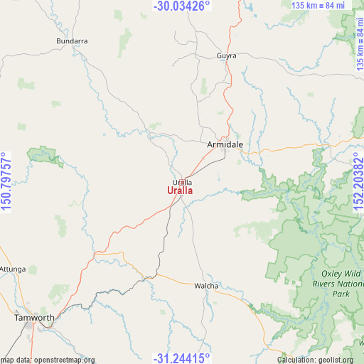
Uralla GPS coordinates[2]
30° 38' 27.96" South, 151° 30' 2.484" East
| Map corner | latitude | longitude |
|---|---|---|
| Upper-left | -30.03426°, | 150.79757° |
| Center: | -30.6411°, | 151.50069° |
| Lower-right: | -31.24415°, | 152.20382° |
| Map W x H: | 134.5×134.5 km | = 83.6×83.6mi |
| max Lat: | -10.58257° ⇑28.6% North |
| Uralla: | -30.6411° |
| min Lat: | ⇓71.4% South -43.31423° |
| min Long | Uralla | max Long |
| 113.53327° | 151.50069° | 153.61246° |
| W 77.8%⇐ | ⇒22.2% E |
Elevation
Elevation of Uralla is 1005 m = 3297 ft, and this is 883 m = 2897 ft above average elevation for this country.
| Max E: |
1715 m = 5627 ft | 0.3% |
| Uralla | 1005 m 3297 ft | |
| Avg. | 122 m = 400 ft | |
Min E: |
-2 m = -7 ft | 99.7% |
See also: Australia elevation on elevation.city.
Geographical zone
Uralla is located in South temperate zone (between Tropic of Capricorn and the Antarctic Circle). Distance of this Southern Tropic circle is 801.1 km =497.8 mi to North.| Distance of | km | miles | from Uralla |
|---|---|---|---|
| Equator | 3407 | 2117 | to North |
| Tropic Capricorn | 801.1 | 497.8 | to North |
| Antarctic Circle | 3994.2 | 2481.9 | to South |
| South Pole | 6600.1 | 4101.1 | to South |


Nearby cities:
15 places around Uralla: (largest is in red/bold)
• Armidale
22.2 km =13.8 mi,  45°
45°
• Attunga
70.3 km =43.7 mi,  242°
242°
• Bundarra
66.2 km =41.1 mi,  322°
322°
• Daruka
67.1 km =41.7 mi,  228°
228°
• East Tamworth
73 km =45.4 mi, 227°
• Guyra
49.8 km =30.9 mi,  18°
18°
• Hallsville
72.6 km =45.1 mi, 235°
• Invergowrie
14.4 km =8.9 mi,  2°
2°
• Kootingal
63.1 km =39.2 mi,  222°
222°
• Moonbi
58.7 km =36.5 mi, 224°
• Moore
68.6 km =42.6 mi, 235°
• Nemingha
72.5 km =45 mi, 222°
• North Tamworth
73.6 km =45.7 mi, 228°
• Tamworth
74 km =46 mi, 227°
• Walcha
39.2 km =24.4 mi,  166°
166°
Sources, notices
• [Note1] Compared only with cities in Australia existing in our database
• [Src1] Map data: © OpenStreetMap contributors (CC-BY-SA)
• [Src2] Other city data from geonames.org with taken over terms of usage.
• [Src3] Geographical zone / Annual Mean Temperature by Robert A. Rohde @ Wikipedia
