Invergowrie geodata
Invergowrie (New South Wales) is a section of populated place; located in Australia in Australia/Sydney (GMT+11) time zone. With population of 755 people, there are 4234 cities with bigger population in this country. Compared to other cities in Australia, 71.5% of cities are located further ↓South; 77.9% of cities are located further ←West and 99.6% of cities have lower elevation than Invergowrie. Note1


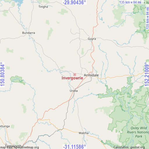
Invergowrie GPS coordinates[2]
30° 30' 43.2" South, 151° 30' 25.056" East
| Map corner | latitude | longitude |
|---|---|---|
| Upper-left | -29.90436°, | 150.80384° |
| Center: | -30.512°, | 151.50696° |
| Lower-right: | -31.11586°, | 152.21009° |
| Map W x H: | 134.7×134.7 km | = 83.7×83.7mi |
| max Lat: | -10.58257° ⇑28.5% North |
| Invergowrie: | -30.512° |
| min Lat: | ⇓71.5% South -43.31423° |
| min Long | Invergowrie | max Long |
| 113.53327° | 151.50696° | 153.61246° |
| W 77.9%⇐ | ⇒22.1% E |
Elevation
Elevation of Invergowrie is 964 m = 3163 ft, and this is 842 m = 2762 ft above average elevation for this country.
| Max E: |
1715 m = 5627 ft | 0.40000000000001% |
| Invergowrie | 964 m 3163 ft | |
| Avg. | 122 m = 400 ft | |
Min E: |
-2 m = -7 ft | 99.6% |
See also: Australia elevation on elevation.city.
Geographical zone
Invergowrie is located in South temperate zone (between Tropic of Capricorn and the Antarctic Circle). Distance of this Southern Tropic circle is 786.7 km =488.8 mi to North.| Distance of | km | miles | from Invergowrie |
|---|---|---|---|
| Equator | 3392.6 | 2108.1 | to North |
| Tropic Capricorn | 786.7 | 488.8 | to North |
| Antarctic Circle | 4008.6 | 2490.8 | to South |
| South Pole | 6614.4 | 4110 | to South |


Nearby cities:
15 places around Invergowrie: (largest is in red/bold)
• Armidale
15.2 km =9.4 mi,  85°
85°
• Attunga
78.4 km =48.7 mi,  233°
233°
• Bundarra
56 km =34.8 mi,  312°
312°
• Daruka
77.7 km =48.3 mi,  221°
221°
• East Tamworth
83.8 km =52.1 mi, 220°
• Gilgai
82.3 km =51.1 mi,  332°
332°
• Guyra
36.3 km =22.6 mi,  25°
25°
• Hallsville
82.1 km =51 mi, 227°
• Kootingal
74.6 km =46.4 mi, 215°
• Manilla
79.7 km =49.5 mi,  250°
250°
• Moonbi
70 km =43.5 mi, 216°
• Moore
78.1 km =48.5 mi, 226°
• Tingha
68 km =42.3 mi,  335°
335°
• Uralla
14.4 km =8.9 mi,  182°
182°
• Walcha
53.2 km =33.1 mi,  171°
171°
Sources, notices
• [Note1] Compared only with cities in Australia existing in our database
• [Src1] Map data: © OpenStreetMap contributors (CC-BY-SA)
• [Src2] Other city data from geonames.org with taken over terms of usage.
• [Src3] Geographical zone / Annual Mean Temperature by Robert A. Rohde @ Wikipedia
