Toowong geodata
Toowong (Queensland) is a section of populated place; located in Australia in Australia/Brisbane (GMT+10) time zone. With population of 10,780 people, there are 509 cities with bigger population in this country. Compared to other cities in Australia, 82.2% of cities are located further ↓South; 90.5% of cities are located further ←West and 53.1% of cities have higher elevation than Toowong. Note1


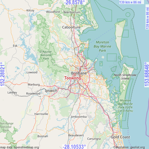
Toowong GPS coordinates[2]
27° 28' 59.988" South, 152° 58' 59.988" East
| Map corner | latitude | longitude |
|---|---|---|
| Upper-left | -26.8578°, | 152.28021° |
| Center: | -27.48333°, | 152.98333° |
| Lower-right: | -28.10533°, | 153.68646° |
| Map W x H: | 138.7×138.7 km | = 86.2×86.2mi |
| max Lat: | -10.58257° ⇑17.8% North |
| Toowong: | -27.48333° |
| min Lat: | ⇓82.2% South -43.31423° |
| min Long | Toowong | max Long |
| 113.53327° | 152.98333° | 153.61246° |
| W 90.5%⇐ | ⇒9.5% E |
Elevation
Elevation of Toowong is 41 m = 135 ft, and this is 81 m = 266 ft below average elevation for this country.
| Max E: |
1715 m = 5627 ft | 53.1% |
| Avg. | 122 m = 400 ft | |
| Toowong | 41 m = 135 ft | |
Min E: |
-2 m = -7 ft | 46.9% |
See also: Australia elevation on elevation.city.
Geographical zone
Toowong is located in South temperate zone (between Tropic of Capricorn and the Antarctic Circle). Distance of this Southern Tropic circle is 449.9 km =279.6 mi to North.| Distance of | km | miles | from Toowong |
|---|---|---|---|
| Equator | 3055.9 | 1898.8 | to North |
| Tropic Capricorn | 449.9 | 279.6 | to North |
| Antarctic Circle | 4345.3 | 2700 | to South |
| South Pole | 6951.2 | 4319.3 | to South |


Nearby cities:
15 places around Toowong: (largest is in red/bold)
• Ashgrove
4.3 km =2.7 mi,  11°
11°
• Auchenflower
1.3 km =0.8 mi,  41°
41°
• Bardon
2.5 km =1.6 mi,  350°
350°
• Chapel Hill
3.9 km =2.4 mi,  236°
236°
• Chelmer
3.4 km =2.1 mi,  193°
193°
• Graceville
4.3 km =2.7 mi,  181°
181°
• Highgate Hill
3.6 km =2.2 mi,  100°
100°
• Indooroopilly
2.3 km =1.4 mi,  200°
200°
• Milton
2.4 km =1.5 mi,  53°
53°
• Paddington
2.9 km =1.8 mi,  23°
23°
• Petrie Terrace
3.7 km =2.3 mi, 52°
• Red Hill
3.9 km =2.4 mi,  28°
28°
• South Brisbane
3.7 km =2.3 mi,  84°
84°
• Taringa
0.9 km =0.6 mi,  209°
209°
• West End
2.6 km =1.6 mi, 80°
Sources, notices
• [Note1] Compared only with cities in Australia existing in our database
• [Src1] Map data: © OpenStreetMap contributors (CC-BY-SA)
• [Src2] Other city data from geonames.org with taken over terms of usage.
• [Src3] Geographical zone / Annual Mean Temperature by Robert A. Rohde @ Wikipedia
