Southbrook geodata
Southbrook (Queensland) is a populated place; located in Australia in Australia/Brisbane (GMT+10) time zone. With population of 576 people, there are 4628 cities with bigger population in this country. Compared to other cities in Australia, 77.8% of cities are located further ↓South; 80.7% of cities are located further ←West and 93.9% of cities have lower elevation than Southbrook. Note1


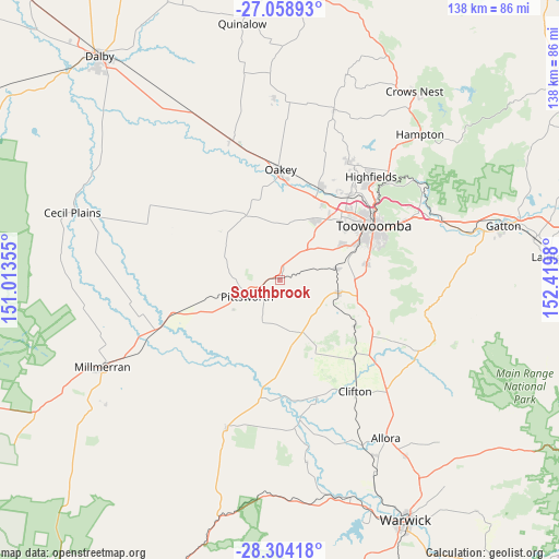
Southbrook GPS coordinates[2]
27° 40' 59.988" South, 151° 43' 0.012" East
| Map corner | latitude | longitude |
|---|---|---|
| Upper-left | -27.05893°, | 151.01355° |
| Center: | -27.68333°, | 151.71667° |
| Lower-right: | -28.30418°, | 152.4198° |
| Map W x H: | 138.5×138.5 km | = 86.1×86.1mi |
| max Lat: | -10.58257° ⇑22.2% North |
| Southbrook: | -27.68333° |
| min Lat: | ⇓77.8% South -43.31423° |
| min Long | Southbrook | max Long |
| 113.53327° | 151.71667° | 153.61246° |
| W 80.7%⇐ | ⇒19.3% E |
Elevation
Elevation of Southbrook is 531 m = 1742 ft, and this is 409 m = 1342 ft above average elevation for this country.
| Max E: |
1715 m = 5627 ft | 6.1% |
| Southbrook | 531 m 1742 ft | |
| Avg. | 122 m = 400 ft | |
Min E: |
-2 m = -7 ft | 93.9% |
See also: Australia elevation on elevation.city.
Geographical zone
Southbrook is located in South temperate zone (between Tropic of Capricorn and the Antarctic Circle). Distance of this Southern Tropic circle is 472.2 km =293.4 mi to North.| Distance of | km | miles | from Southbrook |
|---|---|---|---|
| Equator | 3078.1 | 1912.6 | to North |
| Tropic Capricorn | 472.2 | 293.4 | to North |
| Antarctic Circle | 4323.1 | 2686.2 | to South |
| South Pole | 6929 | 4305.5 | to South |


Nearby cities:
15 places around Southbrook: (largest is in red/bold)
• Cambooya
14.6 km =9.1 mi,  103°
103°
• Cotswold Hills
25.1 km =15.6 mi,  44°
44°
• Darling Heights
23.2 km =14.4 mi,  65°
65°
• Drayton
20.4 km =12.7 mi,  63°
63°
• Glenvale
21.6 km =13.4 mi,  53°
53°
• Greenmount
21.4 km =13.3 mi,  122°
122°
• Harristown
24.1 km =15 mi, 62°
• Hodgson Vale
21.3 km =13.2 mi,  84°
84°
• Kearneys Spring
23.8 km =14.8 mi, 68°
• Kingsthorpe
25 km =15.5 mi,  22°
22°
• Pittsworth
8.9 km =5.5 mi,  245°
245°
• Top Camp
22.5 km =14 mi, 76°
• Torrington
23 km =14.3 mi, 47°
• Westbrook
16.5 km =10.3 mi, 63°
• Wyreema
14 km =8.7 mi, 77°
Sources, notices
• [Note1] Compared only with cities in Australia existing in our database
• [Src1] Map data: © OpenStreetMap contributors (CC-BY-SA)
• [Src2] Other city data from geonames.org with taken over terms of usage.
• [Src3] Geographical zone / Annual Mean Temperature by Robert A. Rohde @ Wikipedia
