Pittsworth geodata
Pittsworth (Queensland) is a populated place; located in Australia in Australia/Brisbane (GMT+10) time zone. With population of 3,197 people, there are 2132 cities with bigger population in this country. Compared to other cities in Australia, 77.6% of cities are located further ↓South; 79.5% of cities are located further ←West and 93.8% of cities have lower elevation than Pittsworth. Note1


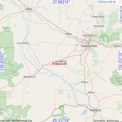
Pittsworth GPS coordinates[2]
27° 42' 58.968" South, 151° 38' 2.364" East
| Map corner | latitude | longitude |
|---|---|---|
| Upper-left | -27.09216°, | 150.93087° |
| Center: | -27.71638°, | 151.63399° |
| Lower-right: | -28.33704°, | 152.33712° |
| Map W x H: | 138.4×138.4 km | = 86×86mi |
| max Lat: | -10.58257° ⇑22.4% North |
| Pittsworth: | -27.71638° |
| min Lat: | ⇓77.6% South -43.31423° |
| min Long | Pittsworth | max Long |
| 113.53327° | 151.63399° | 153.61246° |
| W 79.5%⇐ | ⇒20.5% E |
Elevation
Elevation of Pittsworth is 523 m = 1716 ft, and this is 401 m = 1316 ft above average elevation for this country.
| Max E: |
1715 m = 5627 ft | 6.2% |
| Pittsworth | 523 m 1716 ft | |
| Avg. | 122 m = 400 ft | |
Min E: |
-2 m = -7 ft | 93.8% |
See also: Australia elevation on elevation.city.
Geographical zone
Pittsworth is located in South temperate zone (between Tropic of Capricorn and the Antarctic Circle). Distance of this Southern Tropic circle is 475.9 km =295.7 mi to North.| Distance of | km | miles | from Pittsworth |
|---|---|---|---|
| Equator | 3081.8 | 1914.9 | to North |
| Tropic Capricorn | 475.9 | 295.7 | to North |
| Antarctic Circle | 4319.4 | 2683.9 | to South |
| South Pole | 6925.3 | 4303.2 | to South |


Nearby cities:
15 places around Pittsworth: (largest is in red/bold)
• Cambooya
22.3 km =13.9 mi,  89°
89°
• Darling Heights
32.1 km =19.9 mi,  65°
65°
• Drayton
29.3 km =18.2 mi,  63°
63°
• Glenvale
30.4 km =18.9 mi, 57°
• Greenmount
27.4 km =17 mi,  106°
106°
• Hodgson Vale
29.9 km =18.6 mi,  79°
79°
• Kearneys Spring
32.7 km =20.3 mi, 67°
• Kingsthorpe
32.1 km =19.9 mi,  33°
33°
• Nobby
30.8 km =19.1 mi,  121°
121°
• Oakey
32.6 km =20.3 mi,  15°
15°
• Southbrook
8.9 km =5.5 mi, 65°
• Top Camp
31.4 km =19.5 mi, 73°
• Torrington
31.6 km =19.6 mi,  52°
52°
• Westbrook
25.5 km =15.8 mi, 64°
• Wyreema
22.8 km =14.2 mi, 72°
Sources, notices
• [Note1] Compared only with cities in Australia existing in our database
• [Src1] Map data: © OpenStreetMap contributors (CC-BY-SA)
• [Src2] Other city data from geonames.org with taken over terms of usage.
• [Src3] Geographical zone / Annual Mean Temperature by Robert A. Rohde @ Wikipedia
