Ravenshoe geodata
Ravenshoe (Queensland) is a populated place; located in Australia in Australia/Brisbane (GMT+10) time zone. With population of 1,452 people, there are 3319 cities with bigger population in this country. Compared to other cities in Australia, 96.4% of cities are located further ↓South; 59.8% of cities are located further →East and 99.3% of cities have lower elevation than Ravenshoe. Note1


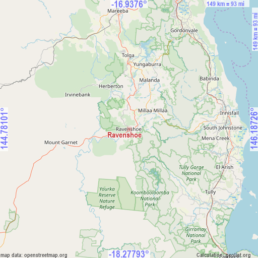
Ravenshoe GPS coordinates[2]
17° 36' 32.436" South, 145° 29' 2.868" East
| Map corner | latitude | longitude |
|---|---|---|
| Upper-left | -16.9376°, | 144.78101° |
| Center: | -17.60901°, | 145.48413° |
| Lower-right: | -18.27793°, | 146.18726° |
| Map W x H: | 149×149 km | = 92.6×92.6mi |
| max Lat: | -10.58257° ⇑3.6% North |
| Ravenshoe: | -17.60901° |
| min Lat: | ⇓96.4% South -43.31423° |
| min Long | Ravenshoe | max Long |
| 113.53327° | 145.48413° | 153.61246° |
| W 40.2%⇐ | ⇒59.8% E |
Elevation
Elevation of Ravenshoe is 909 m = 2982 ft, and this is 787 m = 2582 ft above average elevation for this country.
| Max E: |
1715 m = 5627 ft | 0.7% |
| Ravenshoe | 909 m 2982 ft | |
| Avg. | 122 m = 400 ft | |
Min E: |
-2 m = -7 ft | 99.3% |
See also: Australia elevation on elevation.city.
Geographical zone
Ravenshoe is located in South Torrid zone (between Equator and Tropic of Capricorn). Distance of this Southern Tropic circle is 648 km =402.6 mi to South.| Distance of | km | miles | from Ravenshoe |
|---|---|---|---|
| Equator | 1957.9 | 1216.6 | to North |
| Tropic Capricorn | 648 | 402.6 | to South |
| Antarctic Circle | 5443.2 | 3382.2 | to South |
| South Pole | 8049.1 | 5001.5 | to South |


Nearby cities:
15 places around Ravenshoe: (largest is in red/bold)
• Atherton
37.9 km =23.5 mi,  358°
358°
• Babinda
55.1 km =34.2 mi,  57°
57°
• Belvedere
54.3 km =33.7 mi,  79°
79°
• Goldsborough
57.2 km =35.5 mi,  27°
27°
• Goondi Bend
56.8 km =35.3 mi, 79°
• Herberton
28.2 km =17.5 mi,  338°
338°
• Malanda
30.9 km =19.2 mi,  22°
22°
• Millaa Millaa
17.3 km =10.7 mi,  52°
52°
• Millstream
8.9 km =5.5 mi,  236°
236°
• Peeramon
35.8 km =22.2 mi, 22°
• Tolga
47.1 km =29.3 mi, 359°
• Walkamin
53 km =32.9 mi,  352°
352°
• Wangan
55.5 km =34.5 mi,  86°
86°
• Wondecla
23.2 km =14.4 mi, 337°
• Yungaburra
39.1 km =24.3 mi, 15°
Sources, notices
• [Note1] Compared only with cities in Australia existing in our database
• [Src1] Map data: © OpenStreetMap contributors (CC-BY-SA)
• [Src2] Other city data from geonames.org with taken over terms of usage.
• [Src3] Geographical zone / Annual Mean Temperature by Robert A. Rohde @ Wikipedia
