Moura geodata
Moura (Queensland) is a populated place; located in Australia in Australia/Brisbane (GMT+10) time zone. With population of 2,226 people, there are 2745 cities with bigger population in this country. Compared to other cities in Australia, 90.5% of cities are located further ↓South; 56.9% of cities are located further ←West and 75.7% of cities have lower elevation than Moura. Note1


Moura GPS coordinates[2]
24° 34' 19.92" South, 149° 58' 2.244" East
| Map corner | latitude | longitude |
|---|---|---|
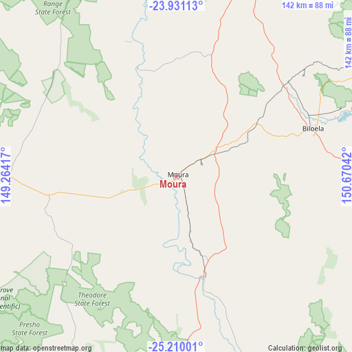
| Upper-left | -23.93113°, | 149.26417° |
| Center: | -24.5722°, | 149.96729° |
| Lower-right: | -25.21001°, | 150.67042° |
| Map W x H: | 142.2×142.2 km | = 88.4×88.4mi |
| max Lat: | -10.58257° ⇑9.5% North |
| Moura: | -24.5722° |
| min Lat: | ⇓90.5% South -43.31423° |
| min Long | Moura | max Long |
| 113.53327° | 149.96729° | 153.61246° |
| W 56.9%⇐ | ⇒43.1% E |
Elevation
Elevation of Moura is 137 m = 449 ft, and this is 15 m = 49 ft above average elevation for this country.
| Max E: |
1715 m = 5627 ft | 24.3% |
| Moura | 137 m 449 ft | |
| Avg. | 122 m = 400 ft | |
Min E: |
-2 m = -7 ft | 75.7% |
See also: Australia elevation on elevation.city.
Geographical zone
Moura is located in South temperate zone (between Tropic of Capricorn and the Antarctic Circle). Distance of this Southern Tropic circle is 126.3 km =78.5 mi to North.| Distance of | km | miles | from Moura |
|---|---|---|---|
| Equator | 2732.2 | 1697.7 | to North |
| Tropic Capricorn | 126.3 | 78.5 | to North |
| Antarctic Circle | 4669 | 2901.2 | to South |
| South Pole | 7274.9 | 4520.4 | to South |


Nearby cities:
15 places around Moura: (largest is in red/bold)
• Allenstown
141.9 km =88.2 mi,  22°
22°
• Biloela
58.8 km =36.5 mi,  70°
70°
• Bouldercombe
122.5 km =76.1 mi, 24°
• Calliope
139.9 km =86.9 mi,  63°
63°
• Depot Hill
143 km =88.9 mi, 23°
• Gracemere
135.6 km =84.3 mi, 21°
• Monto
121.1 km =75.2 mi,  105°
105°
• Mount Morgan
111.6 km =69.3 mi, 22°
• Taroom
119.8 km =74.4 mi,  188°
188°
• Thangool
62.1 km =38.6 mi,  81°
81°
• The Range
141.8 km =88.1 mi, 22°
• Theodore
42.9 km =26.7 mi,  165°
165°
• West Rockhampton
142.6 km =88.6 mi, 21°
• West Stowe
138.9 km =86.3 mi, 58°
• Woorabinda
71.3 km =44.3 mi,  313°
313°
Sources, notices
• [Note1] Compared only with cities in Australia existing in our database
• [Src1] Map data: © OpenStreetMap contributors (CC-BY-SA)
• [Src2] Other city data from geonames.org with taken over terms of usage.
• [Src3] Geographical zone / Annual Mean Temperature by Robert A. Rohde @ Wikipedia
