Taroom geodata
Taroom (Queensland) is a populated place; located in Australia in Australia/Brisbane (GMT+10) time zone. With population of 888 people, there are 3992 cities with bigger population in this country. Compared to other cities in Australia, 88.8% of cities are located further ↓South; 56.6% of cities are located further ←West and 82.4% of cities have lower elevation than Taroom. Note1


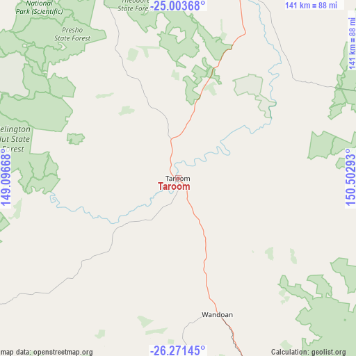
Taroom GPS coordinates[2]
25° 38' 21.3" South, 149° 47' 59.28" East
| Map corner | latitude | longitude |
|---|---|---|
| Upper-left | -25.00368°, | 149.09668° |
| Center: | -25.63925°, | 149.7998° |
| Lower-right: | -26.27145°, | 150.50293° |
| Map W x H: | 141×141 km | = 87.6×87.6mi |
| max Lat: | -10.58257° ⇑11.2% North |
| Taroom: | -25.63925° |
| min Lat: | ⇓88.8% South -43.31423° |
| min Long | Taroom | max Long |
| 113.53327° | 149.7998° | 153.61246° |
| W 56.6%⇐ | ⇒43.4% E |
Elevation
Elevation of Taroom is 210 m = 689 ft, and this is 88 m = 289 ft above average elevation for this country.
| Max E: |
1715 m = 5627 ft | 17.6% |
| Taroom | 210 m 689 ft | |
| Avg. | 122 m = 400 ft | |
Min E: |
-2 m = -7 ft | 82.4% |
See also: Australia elevation on elevation.city.
Geographical zone
Taroom is located in South temperate zone (between Tropic of Capricorn and the Antarctic Circle). Distance of this Southern Tropic circle is 244.9 km =152.2 mi to North.| Distance of | km | miles | from Taroom |
|---|---|---|---|
| Equator | 2850.8 | 1771.4 | to North |
| Tropic Capricorn | 244.9 | 152.2 | to North |
| Antarctic Circle | 4550.4 | 2827.5 | to South |
| South Pole | 7156.2 | 4446.7 | to South |


Nearby cities:
15 places around Taroom: (largest is in red/bold)
• Biloela
155.9 km =96.9 mi,  27°
27°
• Chinchilla
147.6 km =91.7 mi,  145°
145°
• Eidsvold
135.9 km =84.4 mi,  77°
77°
• Gayndah
181.6 km =112.8 mi,  89°
89°
• Jandowae
182.6 km =113.5 mi,  134°
134°
• Miles
119.8 km =74.4 mi,  161°
161°
• Monto
158.4 km =98.4 mi,  57°
57°
• Moura
119.8 km =74.4 mi,  8°
8°
• Mundubbera
150.7 km =93.6 mi, 88°
• Roma
144.5 km =89.8 mi,  224°
224°
• Thangool
150 km =93.2 mi, 31°
• Theodore
81.9 km =50.9 mi,  19°
19°
• Wandoan
56.1 km =34.9 mi, 163°
• Westcourt
133.7 km =83.1 mi, 164°
• Woorabinda
171.3 km =106.4 mi,  348°
348°
Sources, notices
• [Note1] Compared only with cities in Australia existing in our database
• [Src1] Map data: © OpenStreetMap contributors (CC-BY-SA)
• [Src2] Other city data from geonames.org with taken over terms of usage.
• [Src3] Geographical zone / Annual Mean Temperature by Robert A. Rohde @ Wikipedia
