Theodore geodata
Theodore (Queensland) is a populated place; located in Australia in Australia/Brisbane (GMT+10) time zone. With population of 543 people, there are 4731 cities with bigger population in this country. Compared to other cities in Australia, 89.7% of cities are located further ↓South; 57.1% of cities are located further ←West and 76.9% of cities have lower elevation than Theodore. Note1


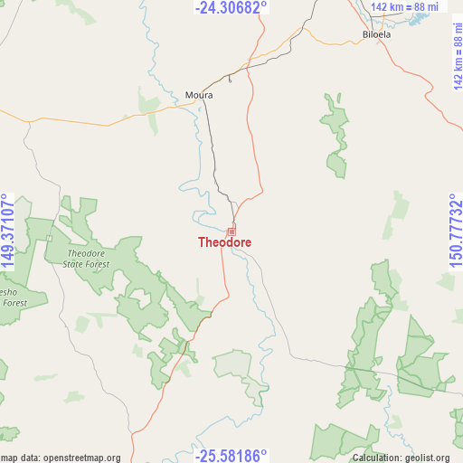
Theodore GPS coordinates[2]
24° 56' 45.564" South, 150° 4' 27.084" East
| Map corner | latitude | longitude |
|---|---|---|
| Upper-left | -24.30682°, | 149.37107° |
| Center: | -24.94599°, | 150.07419° |
| Lower-right: | -25.58186°, | 150.77732° |
| Map W x H: | 141.8×141.8 km | = 88.1×88.1mi |
| max Lat: | -10.58257° ⇑10.3% North |
| Theodore: | -24.94599° |
| min Lat: | ⇓89.7% South -43.31423° |
| min Long | Theodore | max Long |
| 113.53327° | 150.07419° | 153.61246° |
| W 57.1%⇐ | ⇒42.9% E |
Elevation
Elevation of Theodore is 147 m = 482 ft, and this is 25 m = 82 ft above average elevation for this country.
| Max E: |
1715 m = 5627 ft | 23.1% |
| Theodore | 147 m 482 ft | |
| Avg. | 122 m = 400 ft | |
Min E: |
-2 m = -7 ft | 76.9% |
See also: Australia elevation on elevation.city.
Geographical zone
Theodore is located in South temperate zone (between Tropic of Capricorn and the Antarctic Circle). Distance of this Southern Tropic circle is 167.8 km =104.3 mi to North.| Distance of | km | miles | from Theodore |
|---|---|---|---|
| Equator | 2773.7 | 1723.5 | to North |
| Tropic Capricorn | 167.8 | 104.3 | to North |
| Antarctic Circle | 4627.4 | 2875.3 | to South |
| South Pole | 7233.3 | 4494.6 | to South |


Nearby cities:
15 places around Theodore: (largest is in red/bold)
• Biloela
75.7 km =47 mi,  36°
36°
• Bouldercombe
158.1 km =98.2 mi,  14°
14°
• Burua
160.1 km =99.5 mi,  46°
46°
• Calliope
154.6 km =96.1 mi, 47°
• Eidsvold
115.5 km =71.8 mi,  114°
114°
• Monto
106.1 km =65.9 mi,  85°
85°
• Mount Morgan
148.1 km =92 mi, 12°
• Mount Perry
160.5 km =99.7 mi,  99°
99°
• Moura
42.9 km =26.7 mi,  345°
345°
• Mundubbera
142.9 km =88.8 mi,  120°
120°
• Taroom
81.9 km =50.9 mi,  199°
199°
• Thangool
71.8 km =44.6 mi, 44°
• Wandoan
131.4 km =81.6 mi,  184°
184°
• West Stowe
157 km =97.6 mi, 42°
• Woorabinda
110.1 km =68.4 mi,  325°
325°
Sources, notices
• [Note1] Compared only with cities in Australia existing in our database
• [Src1] Map data: © OpenStreetMap contributors (CC-BY-SA)
• [Src2] Other city data from geonames.org with taken over terms of usage.
• [Src3] Geographical zone / Annual Mean Temperature by Robert A. Rohde @ Wikipedia
