Millthorpe geodata
Millthorpe (New South Wales) is a populated place; located in Australia in Australia/Sydney (GMT+11) time zone. With population of 1,208 people, there are 3572 cities with bigger population in this country. Compared to other cities in Australia, 54% of cities are located further ↓South; 55.3% of cities are located further ←West and 99.6% of cities have lower elevation than Millthorpe. Note1


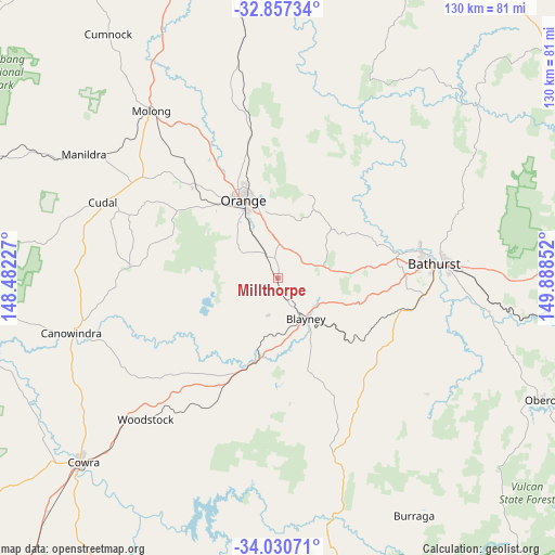
Millthorpe GPS coordinates[2]
33° 26' 45.636" South, 149° 11' 7.404" East
| Map corner | latitude | longitude |
|---|---|---|
| Upper-left | -32.85734°, | 148.48227° |
| Center: | -33.44601°, | 149.18539° |
| Lower-right: | -34.03071°, | 149.88852° |
| Map W x H: | 130.5×130.5 km | = 81.1×81.1mi |
| max Lat: | -10.58257° ⇑46% North |
| Millthorpe: | -33.44601° |
| min Lat: | ⇓54% South -43.31423° |
| min Long | Millthorpe | max Long |
| 113.53327° | 149.18539° | 153.61246° |
| W 55.3%⇐ | ⇒44.7% E |
Elevation
Elevation of Millthorpe is 969 m = 3179 ft, and this is 847 m = 2779 ft above average elevation for this country.
| Max E: |
1715 m = 5627 ft | 0.40000000000001% |
| Millthorpe | 969 m 3179 ft | |
| Avg. | 122 m = 400 ft | |
Min E: |
-2 m = -7 ft | 99.6% |
See also: Australia elevation on elevation.city.
Geographical zone
Millthorpe is located in South temperate zone (between Tropic of Capricorn and the Antarctic Circle). Distance of this Southern Tropic circle is 1112.9 km =691.5 mi to North.| Distance of | km | miles | from Millthorpe |
|---|---|---|---|
| Equator | 3718.8 | 2310.8 | to North |
| Tropic Capricorn | 1112.9 | 691.5 | to North |
| Antarctic Circle | 3682.3 | 2288.1 | to South |
| South Pole | 6288.2 | 3907.3 | to South |


Nearby cities:
15 places around Millthorpe: (largest is in red/bold)
• Abercrombie
34.1 km =21.2 mi,  79°
79°
• Blayney
11.5 km =7.1 mi,  146°
146°
• Cargo
35 km =21.7 mi,  273°
273°
• Clifton Grove
21.4 km =13.3 mi,  352°
352°
• Eglinton
34.4 km =21.4 mi, 77°
• Forest Reefs
10.1 km =6.3 mi,  258°
258°
• Llanarth
34.4 km =21.4 mi, 80°
• Mitchell
34.5 km =21.4 mi,  86°
86°
• Mullion Creek
36.1 km =22.4 mi, 351°
• Orange
19.7 km =12.2 mi,  336°
336°
• Perthville
33.8 km =21 mi,  97°
97°
• Robin Hill
32.3 km =20.1 mi, 85°
• South Bathurst
35.9 km =22.3 mi, 88°
• West Bathurst
35.3 km =21.9 mi, 83°
• Windradyne
33.7 km =20.9 mi, 82°
Sources, notices
• [Note1] Compared only with cities in Australia existing in our database
• [Src1] Map data: © OpenStreetMap contributors (CC-BY-SA)
• [Src2] Other city data from geonames.org with taken over terms of usage.
• [Src3] Geographical zone / Annual Mean Temperature by Robert A. Rohde @ Wikipedia
