Hughenden geodata
Hughenden (Queensland) is a populated place; located in Australia in Australia/Brisbane (GMT+10) time zone. With population of 1,253 people, there are 3517 cities with bigger population in this country. Compared to other cities in Australia, 93.7% of cities are located further ↓South; 72% of cities are located further →East and 88.6% of cities have lower elevation than Hughenden. Note1


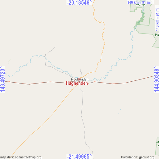
Hughenden GPS coordinates[2]
20° 50' 38.364" South, 144° 12' 1.26" East
| Map corner | latitude | longitude |
|---|---|---|
| Upper-left | -20.18546°, | 143.49723° |
| Center: | -20.84399°, | 144.20035° |
| Lower-right: | -21.49965°, | 144.90348° |
| Map W x H: | 146.1×146.1 km | = 90.8×90.8mi |
| max Lat: | -10.58257° ⇑6.3% North |
| Hughenden: | -20.84399° |
| min Lat: | ⇓93.7% South -43.31423° |
| min Long | Hughenden | max Long |
| 113.53327° | 144.20035° | 153.61246° |
| W 28%⇐ | ⇒72% E |
Elevation
Elevation of Hughenden is 330 m = 1083 ft, and this is 208 m = 682 ft above average elevation for this country.
| Max E: |
1715 m = 5627 ft | 11.4% |
| Hughenden | 330 m 1083 ft | |
| Avg. | 122 m = 400 ft | |
Min E: |
-2 m = -7 ft | 88.6% |
See also: Australia elevation on elevation.city.
Geographical zone
Hughenden is located in South Torrid zone (between Equator and Tropic of Capricorn). Distance of this Southern Tropic circle is 288.3 km =179.1 mi to South.| Distance of | km | miles | from Hughenden |
|---|---|---|---|
| Equator | 2317.6 | 1440.1 | to North |
| Tropic Capricorn | 288.3 | 179.1 | to South |
| Antarctic Circle | 5083.5 | 3158.7 | to South |
| South Pole | 7689.4 | 4778 | to South |


Nearby cities:
15 places around Hughenden: (largest is in red/bold)
• Alice River
302.8 km =188.2 mi,  56°
56°
• Bluewater Park
302.6 km =188 mi,  52°
52°
• Breddan
238 km =147.9 mi,  66°
66°
• Broughton
246.2 km =153 mi, 70°
• Charters Towers
231.2 km =143.7 mi, 68°
• Charters Towers City
231.1 km =143.6 mi, 68°
• Julia Creek
256.5 km =159.4 mi,  274°
274°
• Longreach
288.9 km =179.5 mi,  179°
179°
• McKinlay
304.6 km =189.3 mi,  261°
261°
• Millchester
232.1 km =144.2 mi, 68°
• Queenton
233.1 km =144.8 mi, 68°
• Richmond
110.6 km =68.7 mi,  276°
276°
• Southern Cross
225.5 km =140.1 mi, 66°
• Toll
231.3 km =143.7 mi, 67°
• Winton
208.7 km =129.7 mi,  214°
214°
Sources, notices
• [Note1] Compared only with cities in Australia existing in our database
• [Src1] Map data: © OpenStreetMap contributors (CC-BY-SA)
• [Src2] Other city data from geonames.org with taken over terms of usage.
• [Src3] Geographical zone / Annual Mean Temperature by Robert A. Rohde @ Wikipedia
