Richmond geodata
Richmond (Queensland) is a populated place; located in Australia in Australia/Brisbane (GMT+10) time zone. With population of 758 people, there are 4230 cities with bigger population in this country. Compared to other cities in Australia, 94% of cities are located further ↓South; 73.9% of cities are located further →East and 83.1% of cities have lower elevation than Richmond. Note1


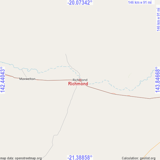
Richmond GPS coordinates[2]
20° 43' 56.748" South, 143° 8' 36.78" East
| Map corner | latitude | longitude |
|---|---|---|
| Upper-left | -20.07342°, | 142.44043° |
| Center: | -20.73243°, | 143.14355° |
| Lower-right: | -21.38858°, | 143.84668° |
| Map W x H: | 146.2×146.2 km | = 90.8×90.8mi |
| max Lat: | -10.58257° ⇑6% North |
| Richmond: | -20.73243° |
| min Lat: | ⇓94% South -43.31423° |
| min Long | Richmond | max Long |
| 113.53327° | 143.14355° | 153.61246° |
| W 26.1%⇐ | ⇒73.9% E |
Elevation
Elevation of Richmond is 219 m = 719 ft, and this is 97 m = 318 ft above average elevation for this country.
| Max E: |
1715 m = 5627 ft | 16.9% |
| Richmond | 219 m 719 ft | |
| Avg. | 122 m = 400 ft | |
Min E: |
-2 m = -7 ft | 83.1% |
See also: Australia elevation on elevation.city.
Geographical zone
Richmond is located in South Torrid zone (between Equator and Tropic of Capricorn). Distance of this Southern Tropic circle is 300.7 km =186.8 mi to South.| Distance of | km | miles | from Richmond |
|---|---|---|---|
| Equator | 2305.2 | 1432.4 | to North |
| Tropic Capricorn | 300.7 | 186.8 | to South |
| Antarctic Circle | 5095.9 | 3166.4 | to South |
| South Pole | 7701.8 | 4785.7 | to South |


Nearby cities:
15 places around Richmond: (largest is in red/bold)
• Breddan
338.5 km =210.3 mi,  75°
75°
• Broughton
349.6 km =217.2 mi, 78°
• Charters Towers
333.2 km =207 mi, 77°
• Charters Towers City
333.1 km =207 mi, 77°
• Cloncurry
273.6 km =170 mi,  270°
270°
• Hughenden
110.6 km =68.7 mi,  96°
96°
• Julia Creek
146.1 km =90.8 mi, 273°
• Longreach
322.1 km =200.1 mi,  159°
159°
• McKinlay
200.4 km =124.5 mi,  252°
252°
• Millchester
334.4 km =207.8 mi, 77°
• Pioneer
378.1 km =234.9 mi, 270°
• Queenton
335.1 km =208.2 mi, 77°
• Southern Cross
326.2 km =202.7 mi, 76°
• Toll
332.8 km =206.8 mi, 76°
• Winton
183.7 km =114.1 mi,  183°
183°
Sources, notices
• [Note1] Compared only with cities in Australia existing in our database
• [Src1] Map data: © OpenStreetMap contributors (CC-BY-SA)
• [Src2] Other city data from geonames.org with taken over terms of usage.
• [Src3] Geographical zone / Annual Mean Temperature by Robert A. Rohde @ Wikipedia
