Greenvale geodata
Greenvale (Victoria) is a section of populated place; located in Australia in Australia/Melbourne (GMT+11) time zone. With population of 15,338 people, there are 261 cities with bigger population in this country. Compared to other cities in Australia, 83.8% of cities are located further ↑North; 68.3% of cities are located further →East and 77.9% of cities have lower elevation than Greenvale. Note1


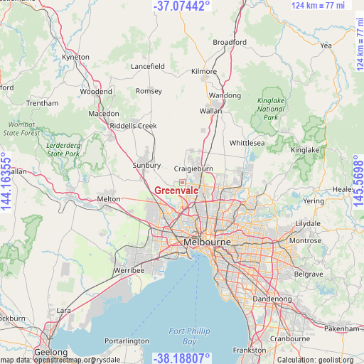
Greenvale GPS coordinates[2]
37° 37' 59.988" South, 144° 52' 0.012" East
| Map corner | latitude | longitude |
|---|---|---|
| Upper-left | -37.07442°, | 144.16355° |
| Center: | -37.63333°, | 144.86667° |
| Lower-right: | -38.18807°, | 145.5698° |
| Map W x H: | 123.8×123.8 km | = 76.9×76.9mi |
| max Lat: | -10.58257° ⇑83.8% North |
| Greenvale: | -37.63333° |
| min Lat: | ⇓16.2% South -43.31423° |
| min Long | Greenvale | max Long |
| 113.53327° | 144.86667° | 153.61246° |
| W 31.7%⇐ | ⇒68.3% E |
Elevation
Elevation of Greenvale is 155 m = 509 ft, and this is 33 m = 108 ft above average elevation for this country.
| Max E: |
1715 m = 5627 ft | 22.1% |
| Greenvale | 155 m 509 ft | |
| Avg. | 122 m = 400 ft | |
Min E: |
-2 m = -7 ft | 77.9% |
See also: Australia elevation on elevation.city.
Geographical zone
Greenvale is located in South temperate zone (between Tropic of Capricorn and the Antarctic Circle). Distance of this Southern Tropic circle is 1578.5 km =980.8 mi to North.| Distance of | km | miles | from Greenvale |
|---|---|---|---|
| Equator | 4184.4 | 2600.1 | to North |
| Tropic Capricorn | 1578.5 | 980.8 | to North |
| Antarctic Circle | 3216.7 | 1998.8 | to South |
| South Pole | 5822.6 | 3618 | to South |


Nearby cities:
15 places around Greenvale: (largest is in red/bold)
• Attwood
4.4 km =2.7 mi,  156°
156°
• Broadmeadows
6.9 km =4.3 mi,  138°
138°
• Bulla
5.3 km =3.3 mi,  263°
263°
• Campbellfield
8.9 km =5.5 mi,  112°
112°
• Coolaroo
6.5 km =4 mi, 113°
• Craigieburn
8.2 km =5.1 mi,  63°
63°
• Dallas
7.3 km =4.5 mi,  124°
124°
• Gladstone Park
6.3 km =3.9 mi, 163°
• Gowanbrae
8.6 km =5.3 mi,  165°
165°
• Jacana
7.2 km =4.5 mi,  147°
147°
• Meadow Heights
5 km =3.1 mi, 113°
• Melbourne Airport
4.7 km =2.9 mi,  196°
196°
• Roxburgh Park
5.3 km =3.3 mi,  80°
80°
• Tullamarine
7.7 km =4.8 mi, 170°
• Westmeadows
5.1 km =3.2 mi, 159°
Sources, notices
• [Note1] Compared only with cities in Australia existing in our database
• [Src1] Map data: © OpenStreetMap contributors (CC-BY-SA)
• [Src2] Other city data from geonames.org with taken over terms of usage.
• [Src3] Geographical zone / Annual Mean Temperature by Robert A. Rohde @ Wikipedia
