Craigieburn geodata
Craigieburn (Victoria) is a section of populated place; located in Australia in Australia/Melbourne (GMT+11) time zone. With population of 50,069 people, there are 30 cities with bigger population in this country. Compared to other cities in Australia, 83.6% of cities are located further ↑North; 67.3% of cities are located further →East and 80.5% of cities have lower elevation than Craigieburn. Note1


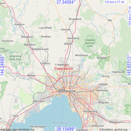
Craigieburn GPS coordinates[2]
37° 36' 0" South, 144° 57' 0" East
| Map corner | latitude | longitude |
|---|---|---|
| Upper-left | -37.04084°, | 144.24688° |
| Center: | -37.6°, | 144.95° |
| Lower-right: | -38.15499°, | 145.65313° |
| Map W x H: | 123.9×123.9 km | = 77×77mi |
| max Lat: | -10.58257° ⇑83.6% North |
| Craigieburn: | -37.6° |
| min Lat: | ⇓16.4% South -43.31423° |
| min Long | Craigieburn | max Long |
| 113.53327° | 144.95° | 153.61246° |
| W 32.7%⇐ | ⇒67.3% E |
Elevation
Elevation of Craigieburn is 186 m = 610 ft, and this is 64 m = 210 ft above average elevation for this country.
| Max E: |
1715 m = 5627 ft | 19.5% |
| Craigieburn | 186 m 610 ft | |
| Avg. | 122 m = 400 ft | |
Min E: |
-2 m = -7 ft | 80.5% |
See also: Craigieburn elevation on elevation.city.
Geographical zone
Craigieburn is located in South temperate zone (between Tropic of Capricorn and the Antarctic Circle). Distance of this Southern Tropic circle is 1574.8 km =978.5 mi to North.| Distance of | km | miles | from Craigieburn |
|---|---|---|---|
| Equator | 4180.7 | 2597.8 | to North |
| Tropic Capricorn | 1574.8 | 978.5 | to North |
| Antarctic Circle | 3220.4 | 2001.1 | to South |
| South Pole | 5826.3 | 3620.3 | to South |


Nearby cities:
15 places around Craigieburn: (largest is in red/bold)
• Attwood
9.5 km =5.9 mi,  215°
215°
• Broadmeadows
9.3 km =5.8 mi,  197°
197°
• Campbellfield
7.1 km =4.4 mi,  173°
173°
• Coolaroo
6.5 km =4 mi,  192°
192°
• Dallas
8 km =5 mi, 189°
• Epping
9.2 km =5.7 mi,  127°
127°
• Greenvale
8.2 km =5.1 mi,  243°
243°
• Jacana
10.3 km =6.4 mi, 199°
• Lalor
9.5 km =5.9 mi,  141°
141°
• Meadow Heights
6.3 km =3.9 mi,  205°
205°
• Mickleham
8.2 km =5.1 mi,  329°
329°
• Roxburgh Park
3.6 km =2.2 mi, 216°
• Thomastown
11 km =6.8 mi,  147°
147°
• Westmeadows
10.1 km =6.3 mi, 213°
• Wollert
7.6 km =4.7 mi,  75°
75°
Sources, notices
• [Note1] Compared only with cities in Australia existing in our database
• [Src1] Map data: © OpenStreetMap contributors (CC-BY-SA)
• [Src2] Other city data from geonames.org with taken over terms of usage.
• [Src3] Geographical zone / Annual Mean Temperature by Robert A. Rohde @ Wikipedia
