Cudgen geodata
Cudgen (New South Wales) is a section of populated place; located in Australia in Australia/Sydney (GMT+11) time zone. With population of 852 people, there are 4058 cities with bigger population in this country. Compared to other cities in Australia, 74.9% of cities are located further ↓South; 99.7% of cities are located further ←West and 67.2% of cities have higher elevation than Cudgen. Note1


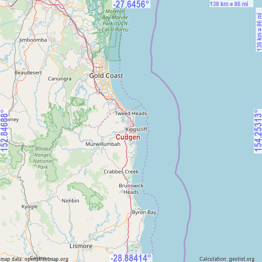
Cudgen GPS coordinates[2]
28° 16' 0.012" South, 153° 33' 0" East
| Map corner | latitude | longitude |
|---|---|---|
| Upper-left | -27.6456°, | 152.84688° |
| Center: | -28.26667°, | 153.55° |
| Lower-right: | -28.88414°, | 154.25313° |
| Map W x H: | 137.7×137.7 km | = 85.6×85.6mi |
| max Lat: | -10.58257° ⇑25.1% North |
| Cudgen: | -28.26667° |
| min Lat: | ⇓74.9% South -43.31423° |
| min Long | Cudgen | max Long |
| 113.53327° | 153.55° | 153.61246° |
| W 99.7%⇐ | ⇒0.3% E |
Elevation
Elevation of Cudgen is 25 m = 82 ft, and this is 97 m = 318 ft below average elevation for this country.
| Max E: |
1715 m = 5627 ft | 67.2% |
| Avg. | 122 m = 400 ft | |
| Cudgen | 25 m = 82 ft | |
Min E: |
-2 m = -7 ft | 32.8% |
See also: Australia elevation on elevation.city.
Geographical zone
Cudgen is located in South temperate zone (between Tropic of Capricorn and the Antarctic Circle). Distance of this Southern Tropic circle is 537 km =333.7 mi to North.| Distance of | km | miles | from Cudgen |
|---|---|---|---|
| Equator | 3143 | 1953 | to North |
| Tropic Capricorn | 537 | 333.7 | to North |
| Antarctic Circle | 4258.2 | 2645.9 | to South |
| South Pole | 6864.1 | 4265.2 | to South |


Nearby cities:
15 places around Cudgen: (largest is in red/bold)
• Banora Point
6.1 km =3.8 mi,  347°
347°
• Bilambil Heights
8.6 km =5.3 mi,  311°
311°
• Bilinga
11.6 km =7.2 mi,  343°
343°
• Bogangar
7.2 km =4.5 mi,  165°
165°
• Casuarina
4.3 km =2.7 mi,  151°
151°
• Chinderah
1.8 km =1.1 mi,  316°
316°
• Coolangatta
10.9 km =6.8 mi, 352°
• Fingal Head
7.4 km =4.6 mi,  11°
11°
• Hastings Point
11.1 km =6.9 mi, 167°
• Kingscliff
2.9 km =1.8 mi,  74°
74°
• Nunderi
10.8 km =6.7 mi,  235°
235°
• Terranora
5.8 km =3.6 mi,  303°
303°
• Tweed Heads
10 km =6.2 mi,  357°
357°
• Tweed Heads South
8 km =5 mi, 352°
• Tweed Heads West
9.2 km =5.7 mi, 343°
Sources, notices
• [Note1] Compared only with cities in Australia existing in our database
• [Src1] Map data: © OpenStreetMap contributors (CC-BY-SA)
• [Src2] Other city data from geonames.org with taken over terms of usage.
• [Src3] Geographical zone / Annual Mean Temperature by Robert A. Rohde @ Wikipedia
