Hastings Point geodata
Hastings Point (New South Wales) is a section of populated place; located in Australia in Australia/Sydney (GMT+11) time zone. With population of 860 people, there are 4042 cities with bigger population in this country. Compared to other cities in Australia, 74.7% of cities are located further ↓South; 99.9% of cities are located further ←West and 91.8% of cities have higher elevation than Hastings Point. Note1


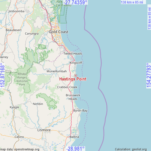
Hastings Point GPS coordinates[2]
28° 21' 50.76" South, 153° 34' 29.28" East
| Map corner | latitude | longitude |
|---|---|---|
| Upper-left | -27.74359°, | 152.87168° |
| Center: | -28.3641°, | 153.5748° |
| Lower-right: | -28.981°, | 154.27793° |
| Map W x H: | 137.6×137.6 km | = 85.5×85.5mi |
| max Lat: | -10.58257° ⇑25.3% North |
| Hastings Point: | -28.3641° |
| min Lat: | ⇓74.7% South -43.31423° |
| min Long | Hastings Point | max Long |
| 113.53327° | 153.5748° | 153.61246° |
| W 99.9%⇐ | ⇒0.099999999999994% E |
Elevation
Elevation of Hastings Point is 8 m = 26 ft, and this is 114 m = 374 ft below average elevation for this country.
| Max E: |
1715 m = 5627 ft | 91.8% |
| Avg. | 122 m = 400 ft | |
| Hastings Point | 8 m = 26 ft | |
Min E: |
-2 m = -7 ft | 8.2% |
See also: Australia elevation on elevation.city.
Geographical zone
Hastings Point is located in South temperate zone (between Tropic of Capricorn and the Antarctic Circle). Distance of this Southern Tropic circle is 547.9 km =340.4 mi to North.| Distance of | km | miles | from Hastings Point |
|---|---|---|---|
| Equator | 3153.8 | 1959.7 | to North |
| Tropic Capricorn | 547.9 | 340.4 | to North |
| Antarctic Circle | 4247.4 | 2639.2 | to South |
| South Pole | 6853.3 | 4258.4 | to South |


Nearby cities:
15 places around Hastings Point: (largest is in red/bold)
• Banora Point
17.2 km =10.7 mi,  347°
347°
• Bogangar
3.9 km =2.4 mi, 351°
• Burringbar
12.7 km =7.9 mi,  231°
231°
• Casuarina
7.1 km =4.4 mi,  356°
356°
• Chinderah
12.7 km =7.9 mi,  343°
343°
• Cudgen
11.1 km =6.9 mi, 347°
• Kingscliff
11.6 km =7.2 mi,  1°
1°
• Nunderi
12.2 km =7.6 mi,  292°
292°
• Ocean Shores
16.5 km =10.3 mi,  192°
192°
• Pottsville
3 km =1.9 mi,  211°
211°
• Pottsville Beach
2.9 km =1.8 mi,  198°
198°
• South Golden Beach
15.1 km =9.4 mi, 190°
• South Murwillumbah
17.3 km =10.7 mi,  279°
279°
• Stokers Siding
16.5 km =10.3 mi,  252°
252°
• Terranora
15.8 km =9.8 mi,  332°
332°
Sources, notices
• [Note1] Compared only with cities in Australia existing in our database
• [Src1] Map data: © OpenStreetMap contributors (CC-BY-SA)
• [Src2] Other city data from geonames.org with taken over terms of usage.
• [Src3] Geographical zone / Annual Mean Temperature by Robert A. Rohde @ Wikipedia
