Clunes geodata
Clunes (Victoria) is a populated place; located in Australia in Australia/Melbourne (GMT+11) time zone. With population of 1,725 people, there are 3092 cities with bigger population in this country. Compared to other cities in Australia, 82.1% of cities are located further ↑North; 73.2% of cities are located further →East and 87.9% of cities have lower elevation than Clunes. Note1


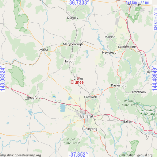
Clunes GPS coordinates[2]
37° 17' 41.028" South, 143° 47' 10.896" East
| Map corner | latitude | longitude |
|---|---|---|
| Upper-left | -36.7333°, | 143.08324° |
| Center: | -37.29473°, | 143.78636° |
| Lower-right: | -37.852°, | 144.48949° |
| Map W x H: | 124.4×124.4 km | = 77.3×77.3mi |
| max Lat: | -10.58257° ⇑82.1% North |
| Clunes: | -37.29473° |
| min Lat: | ⇓17.9% South -43.31423° |
| min Long | Clunes | max Long |
| 113.53327° | 143.78636° | 153.61246° |
| W 26.8%⇐ | ⇒73.2% E |
Elevation
Elevation of Clunes is 309 m = 1014 ft, and this is 187 m = 614 ft above average elevation for this country.
| Max E: |
1715 m = 5627 ft | 12.1% |
| Clunes | 309 m 1014 ft | |
| Avg. | 122 m = 400 ft | |
Min E: |
-2 m = -7 ft | 87.9% |
See also: Australia elevation on elevation.city.
Geographical zone
Clunes is located in South temperate zone (between Tropic of Capricorn and the Antarctic Circle). Distance of this Southern Tropic circle is 1540.9 km =957.5 mi to North.| Distance of | km | miles | from Clunes |
|---|---|---|---|
| Equator | 4146.8 | 2576.7 | to North |
| Tropic Capricorn | 1540.9 | 957.5 | to North |
| Antarctic Circle | 3254.4 | 2022.2 | to South |
| South Pole | 5860.3 | 3641.4 | to South |


Nearby cities:
15 places around Clunes: (largest is in red/bold)
• Ballarat North
28.3 km =17.6 mi,  165°
165°
• Cardigan
26.7 km =16.6 mi,  186°
186°
• Cardigan Village
25.5 km =15.8 mi, 194°
• Carisbrook
27.6 km =17.1 mi,  5°
5°
• Creswick
17.3 km =10.7 mi,  146°
146°
• Invermay
26.1 km =16.2 mi,  161°
161°
• Invermay Park
27 km =16.8 mi, 166°
• Lake Gardens
28.1 km =17.5 mi, 174°
• Lake Wendouree
28.9 km =18 mi, 169°
• Lucas
27.9 km =17.3 mi,  181°
181°
• Maryborough
28 km =17.4 mi,  351°
351°
• Miners Rest
20.7 km =12.9 mi, 176°
• Mitchell Park
23.6 km =14.7 mi, 181°
• Soldiers Hill
29.1 km =18.1 mi, 167°
• Wendouree
26.5 km =16.5 mi, 171°
Sources, notices
• [Note1] Compared only with cities in Australia existing in our database
• [Src1] Map data: © OpenStreetMap contributors (CC-BY-SA)
• [Src2] Other city data from geonames.org with taken over terms of usage.
• [Src3] Geographical zone / Annual Mean Temperature by Robert A. Rohde @ Wikipedia
