Beaconsfield geodata
Beaconsfield (Victoria) is a section of populated place; located in Australia in Australia/Melbourne (GMT+11) time zone. With population of 6,614 people, there are 1045 cities with bigger population in this country. Compared to other cities in Australia, 92.3% of cities are located further ↑North; 60.7% of cities are located further →East and 57.4% of cities have lower elevation than Beaconsfield. Note1


Beaconsfield GPS coordinates[2]
38° 3' 0" South, 145° 22' 0.012" East
| Map corner | latitude | longitude |
|---|---|---|
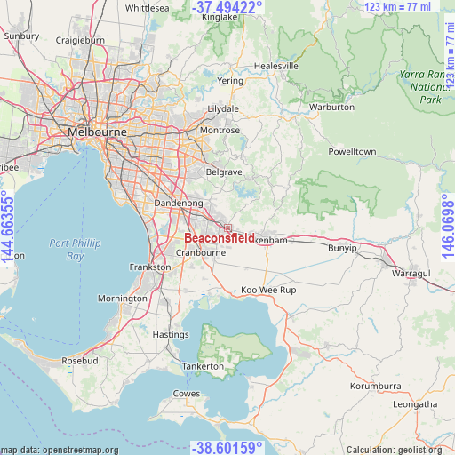
| Upper-left | -37.49422°, | 144.66355° |
| Center: | -38.05°, | 145.36667° |
| Lower-right: | -38.60159°, | 146.0698° |
| Map W x H: | 123.1×123.1 km | = 76.5×76.5mi |
| max Lat: | -10.58257° ⇑92.3% North |
| Beaconsfield: | -38.05° |
| min Lat: | ⇓7.7% South -43.31423° |
| min Long | Beaconsfield | max Long |
| 113.53327° | 145.36667° | 153.61246° |
| W 39.3%⇐ | ⇒60.7% E |
Elevation
Elevation of Beaconsfield is 58 m = 190 ft, and this is 64 m = 210 ft below average elevation for this country.
| Max E: |
1715 m = 5627 ft | 42.6% |
| Avg. | 122 m = 400 ft | |
| Beaconsfield | 58 m = 190 ft | |
Min E: |
-2 m = -7 ft | 57.4% |
See also: Australia elevation on elevation.city.
Geographical zone
Beaconsfield is located in South temperate zone (between Tropic of Capricorn and the Antarctic Circle). Distance of this Southern Tropic circle is 1624.8 km =1009.6 mi to North.| Distance of | km | miles | from Beaconsfield |
|---|---|---|---|
| Equator | 4230.8 | 2628.9 | to North |
| Tropic Capricorn | 1624.8 | 1009.6 | to North |
| Antarctic Circle | 3170.4 | 1970 | to South |
| South Pole | 5776.3 | 3589.2 | to South |


Nearby cities:
15 places around Beaconsfield: (largest is in red/bold)
• Beaconsfield Upper
7.5 km =4.7 mi,  33°
33°
• Berwick
2.4 km =1.5 mi,  321°
321°
• Clyde
9.7 km =6 mi,  197°
197°
• Clyde North
8 km =5 mi, 201°
• Cranbourne
10.1 km =6.3 mi,  225°
225°
• Cranbourne East
9.4 km =5.8 mi,  219°
219°
• Cranbourne North
6.7 km =4.2 mi,  242°
242°
• Hallam
9.5 km =5.9 mi,  292°
292°
• Harkaway
5.7 km =3.5 mi,  345°
345°
• Lynbrook
9.7 km =6 mi,  266°
266°
• Narre Warren
6.1 km =3.8 mi, 287°
• Narre Warren North
8.6 km =5.3 mi,  329°
329°
• Narre Warren South
6.5 km =4 mi,  276°
276°
• Officer
3.9 km =2.4 mi,  105°
105°
• Pakenham
9.7 km =6 mi,  103°
103°
Sources, notices
• [Note1] Compared only with cities in Australia existing in our database
• [Src1] Map data: © OpenStreetMap contributors (CC-BY-SA)
• [Src2] Other city data from geonames.org with taken over terms of usage.
• [Src3] Geographical zone / Annual Mean Temperature by Robert A. Rohde @ Wikipedia
