Wilton geodata
Wilton (New South Wales) is a populated place; located in Australia in Australia/Sydney (GMT+11) time zone. With population of 3,020 people, there are 2244 cities with bigger population in this country. Compared to other cities in Australia, 61.5% of cities are located further ↑North; 60.8% of cities are located further ←West and 83.5% of cities have lower elevation than Wilton. Note1


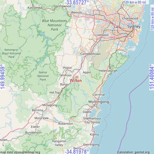
Wilton GPS coordinates[2]
34° 14' 25.908" South, 150° 41' 51.756" East
| Map corner | latitude | longitude |
|---|---|---|
| Upper-left | -33.65727°, | 149.99459° |
| Center: | -34.24053°, | 150.69771° |
| Lower-right: | -34.81978°, | 151.40084° |
| Map W x H: | 129.3×129.3 km | = 80.3×80.3mi |
| max Lat: | -10.58257° ⇑61.5% North |
| Wilton: | -34.24053° |
| min Lat: | ⇓38.5% South -43.31423° |
| min Long | Wilton | max Long |
| 113.53327° | 150.69771° | 153.61246° |
| W 60.8%⇐ | ⇒39.2% E |
Elevation
Elevation of Wilton is 224 m = 735 ft, and this is 102 m = 335 ft above average elevation for this country.
| Max E: |
1715 m = 5627 ft | 16.5% |
| Wilton | 224 m 735 ft | |
| Avg. | 122 m = 400 ft | |
Min E: |
-2 m = -7 ft | 83.5% |
See also: Australia elevation on elevation.city.
Geographical zone
Wilton is located in South temperate zone (between Tropic of Capricorn and the Antarctic Circle). Distance of this Southern Tropic circle is 1201.3 km =746.5 mi to North.| Distance of | km | miles | from Wilton |
|---|---|---|---|
| Equator | 3807.2 | 2365.7 | to North |
| Tropic Capricorn | 1201.3 | 746.5 | to North |
| Antarctic Circle | 3594 | 2233.2 | to South |
| South Pole | 6199.9 | 3852.4 | to South |


Nearby cities:
15 places around Wilton: (largest is in red/bold)
• Appin
9.1 km =5.7 mi,  63°
63°
• Bargo
12.4 km =7.7 mi,  242°
242°
• Buxton
15.3 km =9.5 mi,  261°
261°
• Camden South
17.5 km =10.9 mi,  359°
359°
• Douglas Park
6.4 km =4 mi,  14°
14°
• Menangle
13.2 km =8.2 mi,  16°
16°
• Pheasants Nest
6.1 km =3.8 mi,  253°
253°
• Picton
11.1 km =6.9 mi,  314°
314°
• Razorback
10.6 km =6.6 mi,  337°
337°
• Rosemeadow
17.5 km =10.9 mi,  29°
29°
• St Helens Park
18.5 km =11.5 mi,  35°
35°
• Tahmoor
9.7 km =6 mi,  281°
281°
• Thirlmere
12.6 km =7.8 mi,  288°
288°
• Wedderburn
16.2 km =10.1 mi, 42°
• Yanderra
14.3 km =8.9 mi,  231°
231°
Sources, notices
• [Note1] Compared only with cities in Australia existing in our database
• [Src1] Map data: © OpenStreetMap contributors (CC-BY-SA)
• [Src2] Other city data from geonames.org with taken over terms of usage.
• [Src3] Geographical zone / Annual Mean Temperature by Robert A. Rohde @ Wikipedia
