Cooloola Cove geodata
Cooloola Cove (Queensland) is a populated place; located in Australia in Australia/Brisbane (GMT+10) time zone. With population of 2,555 people, there are 2529 cities with bigger population in this country. Compared to other cities in Australia, 88.7% of cities are located further ↓South; 90.9% of cities are located further ←West and 69.8% of cities have higher elevation than Cooloola Cove. Note1


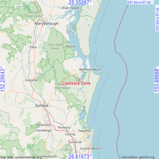
Cooloola Cove GPS coordinates[2]
25° 59' 11.04" South, 152° 59' 36.78" East
| Map corner | latitude | longitude |
|---|---|---|
| Upper-left | -25.35267°, | 152.29043° |
| Center: | -25.9864°, | 152.99355° |
| Lower-right: | -26.61673°, | 153.69668° |
| Map W x H: | 140.6×140.6 km | = 87.4×87.4mi |
| max Lat: | -10.58257° ⇑11.3% North |
| Cooloola Cove: | -25.9864° |
| min Lat: | ⇓88.7% South -43.31423° |
| min Long | Cooloola Cove | max Long |
| 113.53327° | 152.99355° | 153.61246° |
| W 90.9%⇐ | ⇒9.1% E |
Elevation
Elevation of Cooloola Cove is 23 m = 75 ft, and this is 99 m = 325 ft below average elevation for this country.
| Max E: |
1715 m = 5627 ft | 69.8% |
| Avg. | 122 m = 400 ft | |
| Cooloola Cove | 23 m = 75 ft | |
Min E: |
-2 m = -7 ft | 30.2% |
See also: Australia elevation on elevation.city.
Geographical zone
Cooloola Cove is located in South temperate zone (between Tropic of Capricorn and the Antarctic Circle). Distance of this Southern Tropic circle is 283.5 km =176.2 mi to North.| Distance of | km | miles | from Cooloola Cove |
|---|---|---|---|
| Equator | 2889.4 | 1795.4 | to North |
| Tropic Capricorn | 283.5 | 176.2 | to North |
| Antarctic Circle | 4511.8 | 2803.5 | to South |
| South Pole | 7117.6 | 4422.7 | to South |


Nearby cities:
15 places around Cooloola Cove: (largest is in red/bold)
• Araluen
39 km =24.2 mi,  240°
240°
• Chatsworth
41.7 km =25.9 mi,  245°
245°
• Cooroibah
41.9 km =26 mi,  181°
181°
• Cootharaba
31.3 km =19.4 mi, 184°
• East Deep Creek
36.2 km =22.5 mi,  229°
229°
• Gympie
39.8 km =24.7 mi, 235°
• Kin Kin
33.7 km =20.9 mi,  200°
200°
• Monkland
39.9 km =24.8 mi, 231°
• Mothar Mountain
36.6 km =22.7 mi,  216°
216°
• Poona
31.3 km =19.4 mi,  344°
344°
• Rainbow Beach
13.4 km =8.3 mi,  47°
47°
• Tamaree
36.8 km =22.9 mi, 243°
• Tin Can Bay
7.5 km =4.7 mi,  7°
7°
• Veteran
35.9 km =22.3 mi, 237°
• Victory Heights
36.7 km =22.8 mi, 235°
Sources, notices
• [Note1] Compared only with cities in Australia existing in our database
• [Src1] Map data: © OpenStreetMap contributors (CC-BY-SA)
• [Src2] Other city data from geonames.org with taken over terms of usage.
• [Src3] Geographical zone / Annual Mean Temperature by Robert A. Rohde @ Wikipedia
