Karumba geodata
Karumba (Queensland) is a populated place; located in Australia in Australia/Brisbane (GMT+10) time zone. With population of 1,275 people, there are 3499 cities with bigger population in this country. Compared to other cities in Australia, 96.6% of cities are located further ↓South; 75.5% of cities are located further →East and 98.1% of cities have higher elevation than Karumba. Note1


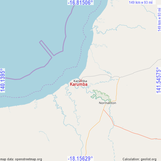
Karumba GPS coordinates[2]
17° 29' 12.876" South, 140° 50' 33.432" East
| Map corner | latitude | longitude |
|---|---|---|
| Upper-left | -16.81506°, | 140.1395° |
| Center: | -17.48691°, | 140.84262° |
| Lower-right: | -18.15629°, | 141.54575° |
| Map W x H: | 149.1×149.1 km | = 92.6×92.6mi |
| max Lat: | -10.58257° ⇑3.4% North |
| Karumba: | -17.48691° |
| min Lat: | ⇓96.6% South -43.31423° |
| min Long | Karumba | max Long |
| 113.53327° | 140.84262° | 153.61246° |
| W 24.5%⇐ | ⇒75.5% E |
Elevation
Elevation of Karumba is 4 m = 13 ft, and this is 118 m = 387 ft below average elevation for this country.
| Max E: |
1715 m = 5627 ft | 98.1% |
| Avg. | 122 m = 400 ft | |
| Karumba | 4 m = 13 ft | |
Min E: |
-2 m = -7 ft | 1.9% |
See also: Australia elevation on elevation.city.
Geographical zone
Karumba is located in South Torrid zone (between Equator and Tropic of Capricorn). Distance of this Southern Tropic circle is 661.6 km =411.1 mi to South.| Distance of | km | miles | from Karumba |
|---|---|---|---|
| Equator | 1944.4 | 1208.2 | to North |
| Tropic Capricorn | 661.6 | 411.1 | to South |
| Antarctic Circle | 5456.8 | 3390.7 | to South |
| South Pole | 8062.7 | 5009.9 | to South |


Nearby cities:
15 places around Karumba: (largest is in red/bold)
• Cloncurry
359.7 km =223.5 mi,  185°
185°
• Doomadgee
219.4 km =136.3 mi,  256°
256°
• Julia Creek
364.8 km =226.7 mi,  164°
164°
• Kowanyama
243.7 km =151.4 mi,  23°
23°
• Menzies
386.1 km =239.9 mi,  201°
201°
• Mornington
387.8 km =241 mi, 201°
• Mount Isa
386.8 km =240.3 mi, 201°
• Normanton
32.3 km =20.1 mi,  129°
129°
• Pioneer
385.9 km =239.8 mi, 201°
• Pormpuraaw
299.5 km =186.1 mi, 16°
• Soldiers Hill
385 km =239.2 mi, 201°
• Sunset
384.8 km =239.1 mi, 201°
• Townview
387.3 km =240.7 mi, 201°
• Wellesley Islands
180.3 km =112 mi,  301°
301°
• Winston
384.5 km =238.9 mi, 201°
Sources, notices
• [Note1] Compared only with cities in Australia existing in our database
• [Src1] Map data: © OpenStreetMap contributors (CC-BY-SA)
• [Src2] Other city data from geonames.org with taken over terms of usage.
• [Src3] Geographical zone / Annual Mean Temperature by Robert A. Rohde @ Wikipedia
