Girards Hill geodata
Girards Hill (New South Wales) is a section of populated place; located in Australia in Australia/Sydney (GMT+11) time zone. With population of 1,329 people, there are 3448 cities with bigger population in this country. Compared to other cities in Australia, 73.5% of cities are located further ↓South; 97.5% of cities are located further ←West and 69.8% of cities have higher elevation than Girards Hill. Note1


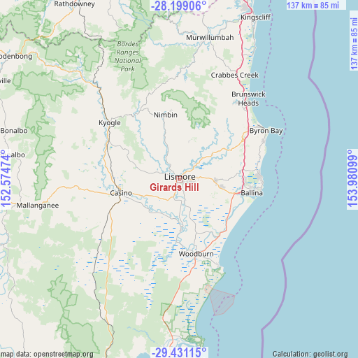
Girards Hill GPS coordinates[2]
28° 49' 0.948" South, 153° 16' 40.296" East
| Map corner | latitude | longitude |
|---|---|---|
| Upper-left | -28.19906°, | 152.57474° |
| Center: | -28.81693°, | 153.27786° |
| Lower-right: | -29.43115°, | 153.98099° |
| Map W x H: | 137×137 km | = 85.1×85.1mi |
| max Lat: | -10.58257° ⇑26.5% North |
| Girards Hill: | -28.81693° |
| min Lat: | ⇓73.5% South -43.31423° |
| min Long | Girards Hill | max Long |
| 113.53327° | 153.27786° | 153.61246° |
| W 97.5%⇐ | ⇒2.5% E |
Elevation
Elevation of Girards Hill is 23 m = 75 ft, and this is 99 m = 325 ft below average elevation for this country.
| Max E: |
1715 m = 5627 ft | 69.8% |
| Avg. | 122 m = 400 ft | |
| Girards Hill | 23 m = 75 ft | |
Min E: |
-2 m = -7 ft | 30.2% |
See also: Australia elevation on elevation.city.
Geographical zone
Girards Hill is located in South temperate zone (between Tropic of Capricorn and the Antarctic Circle). Distance of this Southern Tropic circle is 598.2 km =371.7 mi to North.| Distance of | km | miles | from Girards Hill |
|---|---|---|---|
| Equator | 3204.1 | 1990.9 | to North |
| Tropic Capricorn | 598.2 | 371.7 | to North |
| Antarctic Circle | 4197 | 2607.9 | to South |
| South Pole | 6802.9 | 4227.1 | to South |


Nearby cities:
15 places around Girards Hill: (largest is in red/bold)
• Alstonville
16.1 km =10 mi,  99°
99°
• Caniaba
7.4 km =4.6 mi,  258°
258°
• Clunes
15.8 km =9.8 mi,  52°
52°
• Coraki
19.5 km =12.1 mi,  178°
178°
• Dunoon
15.2 km =9.4 mi,  14°
14°
• East Lismore
1.5 km =0.9 mi,  133°
133°
• Goonellabah
3.8 km =2.4 mi,  89°
89°
• Lismore
0.4 km =0.2 mi,  351°
351°
• Lismore Heights
2.8 km =1.7 mi, 51°
• McLeans Ridges
10.4 km =6.5 mi,  79°
79°
• Modanville
11.5 km =7.1 mi, 11°
• North Casino
20.7 km =12.9 mi,  274°
274°
• North Lismore
3.1 km =1.9 mi,  4°
4°
• South Lismore
2.1 km =1.3 mi, 271°
• Wollongbar
11.6 km =7.2 mi, 90°
Sources, notices
• [Note1] Compared only with cities in Australia existing in our database
• [Src1] Map data: © OpenStreetMap contributors (CC-BY-SA)
• [Src2] Other city data from geonames.org with taken over terms of usage.
• [Src3] Geographical zone / Annual Mean Temperature by Robert A. Rohde @ Wikipedia
