Geneva geodata
Geneva (New South Wales) is a section of populated place; located in Australia in Australia/Sydney (GMT+11) time zone. With population of 698 people, there are 4329 cities with bigger population in this country. Compared to other cities in Australia, 74.4% of cities are located further ↓South; 90.8% of cities are located further ←West and 57.4% of cities have lower elevation than Geneva. Note1


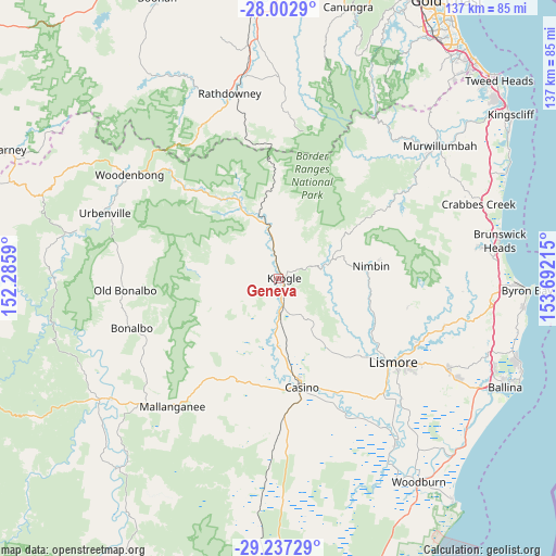
Geneva GPS coordinates[2]
28° 37' 18.876" South, 152° 59' 20.472" East
| Map corner | latitude | longitude |
|---|---|---|
| Upper-left | -28.0029°, | 152.2859° |
| Center: | -28.62191°, | 152.98902° |
| Lower-right: | -29.23729°, | 153.69215° |
| Map W x H: | 137.3×137.3 km | = 85.3×85.3mi |
| max Lat: | -10.58257° ⇑25.6% North |
| Geneva: | -28.62191° |
| min Lat: | ⇓74.4% South -43.31423° |
| min Long | Geneva | max Long |
| 113.53327° | 152.98902° | 153.61246° |
| W 90.8%⇐ | ⇒9.2% E |
Elevation
Elevation of Geneva is 58 m = 190 ft, and this is 64 m = 210 ft below average elevation for this country.
| Max E: |
1715 m = 5627 ft | 42.6% |
| Avg. | 122 m = 400 ft | |
| Geneva | 58 m = 190 ft | |
Min E: |
-2 m = -7 ft | 57.4% |
See also: Australia elevation on elevation.city.
Geographical zone
Geneva is located in South temperate zone (between Tropic of Capricorn and the Antarctic Circle). Distance of this Southern Tropic circle is 576.5 km =358.2 mi to North.| Distance of | km | miles | from Geneva |
|---|---|---|---|
| Equator | 3182.5 | 1977.5 | to North |
| Tropic Capricorn | 576.5 | 358.2 | to North |
| Antarctic Circle | 4218.7 | 2621.4 | to South |
| South Pole | 6824.6 | 4240.6 | to South |


Nearby cities:
15 places around Geneva: (largest is in red/bold)
• Caniaba
31.2 km =19.4 mi,  137°
137°
• Casino
26.9 km =16.7 mi,  167°
167°
• Dunoon
32.8 km =20.4 mi,  102°
102°
• East Lismore
37 km =23 mi,  127°
127°
• Girards Hill
35.5 km =22.1 mi, 127°
• Goonellabah
38.6 km =24 mi,  124°
124°
• Kyogle
0.8 km =0.5 mi, 96°
• Lismore
35.3 km =21.9 mi, 127°
• Lismore Heights
36.3 km =22.6 mi, 123°
• Modanville
32.2 km =20 mi,  108°
108°
• Nimbin
23.1 km =14.4 mi,  82°
82°
• North Casino
21.4 km =13.3 mi,  159°
159°
• North Lismore
33.9 km =21.1 mi, 123°
• South Lismore
33.9 km =21.1 mi, 129°
• Tyalgum
36.3 km =22.6 mi,  35°
35°
Sources, notices
• [Note1] Compared only with cities in Australia existing in our database
• [Src1] Map data: © OpenStreetMap contributors (CC-BY-SA)
• [Src2] Other city data from geonames.org with taken over terms of usage.
• [Src3] Geographical zone / Annual Mean Temperature by Robert A. Rohde @ Wikipedia
